

Alaska


The most common and recognisable Alaskan licence plate is all yellow. In Generation 4 coverage you can also get a plate with a large orange circle in the middle. Front plates are required in Alaska.

The Alaskan highway shield has an image of the Big Dipper constellation on the bottom left.

Trees in Alaska are generally thinner and have less broad leaves than those seen in the other 49 states.

On a lot of the Alaskan coverage you will be able to see tall, snow covered mountains.
In most of the US, Generation 2 is rare. However, Alaska has a fair amount of Generation 2 coverage.

Alaska has Generation 4 “smallcam” coverage, which is mounted lower than regular Generation 4 and has a relatively big circular blur with a small protrusion at the front, with the front of the white car being very visible. The blur can also be fully transparent.

Alaska is the only state in the US where shitcam coverage is prevalent. This coverage is lower resolution with more faded colours, compared to other camera generations. Also, a large blur can be seen at the bottom of the page.

This map shows which parts of Alaska have coverage and which camera generation was used to cover each road.

Generation 4 coverage in Alaska is concentrated around the city of Anchorage.

Most of interior and northern Alaska lies in subarctic or tundra climate zones. These areas feature relatively low amounts of forest undergrowth and shorter trees.

The Alaskan towns in the Alexander Archipelago, on the British Columbia border have a unique look. Tall mountains with lush green forests can be seen in the background, with the majority of buildings made of wood. In addition, Generation 2 coverage is often overcast and misty.
NOTE: Coastal areas of Oregon and Washington can have a similar appearance in terms of landscape and foliage.

The only two major urban areas in Alaska are Anchorage and Fairbanks.

Most of the suburban areas in Alaska are in and around Anchorage.These areas feature wide roads, commercial districts, and sometimes heavy traffic. Mountains can commonly be seen in the distance.
NOTE: Fairbanks has some similar areas, but mountains are less prevalent.

Aspen trees (Populus tremuloides) can be found in lower elevation areas of interior and south-central regions of Alaska. These trees have white bark and rounded leaves.

Due to Alaska’s very cold climate; agricultural fields are mainly found in the south of the state, mostly in the Matanuska Valley and Kenai Peninsula.

The Alaskan pipeline which is usually visible from main roads, can be seen at these points. This is an easy way to identify Alaska as there are no similar pipelines in the rest of the US.

Juneau, Alaska’s Capital city, is the largest settlement in the Alaskan panhandle. Therefore, it is much more ‘built up’ than other towns in this area. The city is surrounded by heavily forested mountains and hills.

Fire hydrants in Anchorage are typically pale pink or pale yellow in colour.
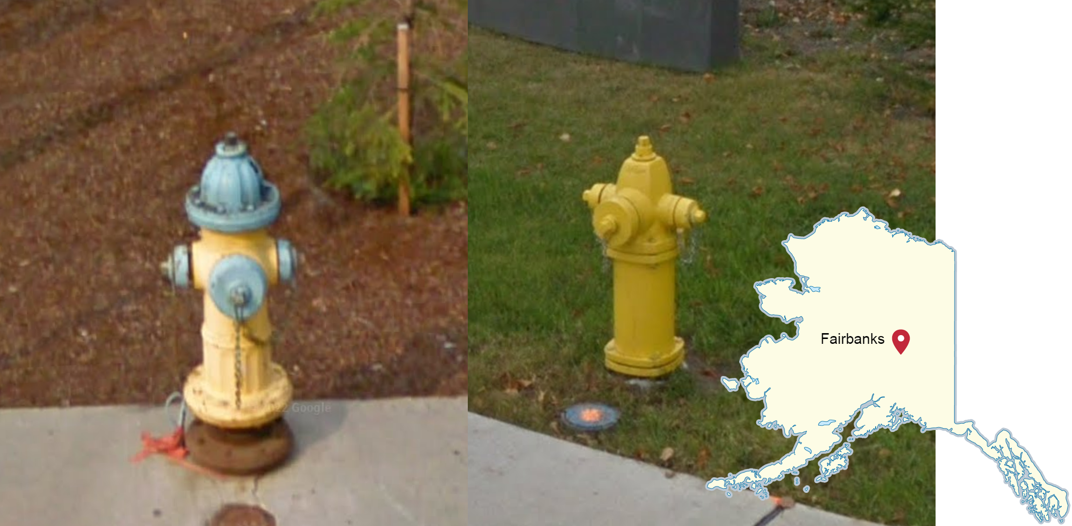
Fire hydrants in Fairbanks are commonly either bright yellow or a combination of colours (most commonly yellow and blue).

Shitcam is only found around Anchorage and Fairbanks, and parts of the road that connects them.
NOTE: This map shows all places where this camera can be found. Keep in mind coverage may be updated in some places, therefore you may come across regular coverage in places highlighted here.

The North end of the Dalton Highway features a flat and snowy landscape and an overcast sky. A small ridge of hills can be seen to the west of the highway in certain spots.

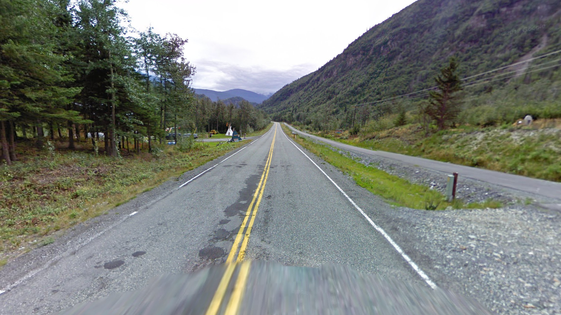
The Denali highway, stretching from Cantwell to Paxson in central Alaska, is a mostly gravel highway in the ‘Alaska’ mountain range. This road runs generally east to west, is covered in the generation 2 camera, and was taken in late summer, so wildflowers and green shrubby plants are common.

The Steese Highway is another gravel highway that goes from Fairbanks to the town of ‘Central.’ Similar to the Denali highway, this road runs generally east to west and is covered in generation 2. The difference, however, is that the mountains along this road are noticeably lower than the ones adjacent to the Denali Highway.

Highway 5, from the Yukon border to Tetlin Junction, can be recognized by the foggy, rainy weather, and Generation 2 camera.
NOTE: The Top of the World Highway on the Canadian side also has similar weather, but is mostly paved and has no outer lines, unlike the American side, which is only paved west of Chicken, and does have outer lines.

Prudhoe Bay, the northernmost town in America covered by street view, can be recognized by cold, dead landscape, overcast clouds and lack of tall buildings. A second Google car can sometimes be seen.
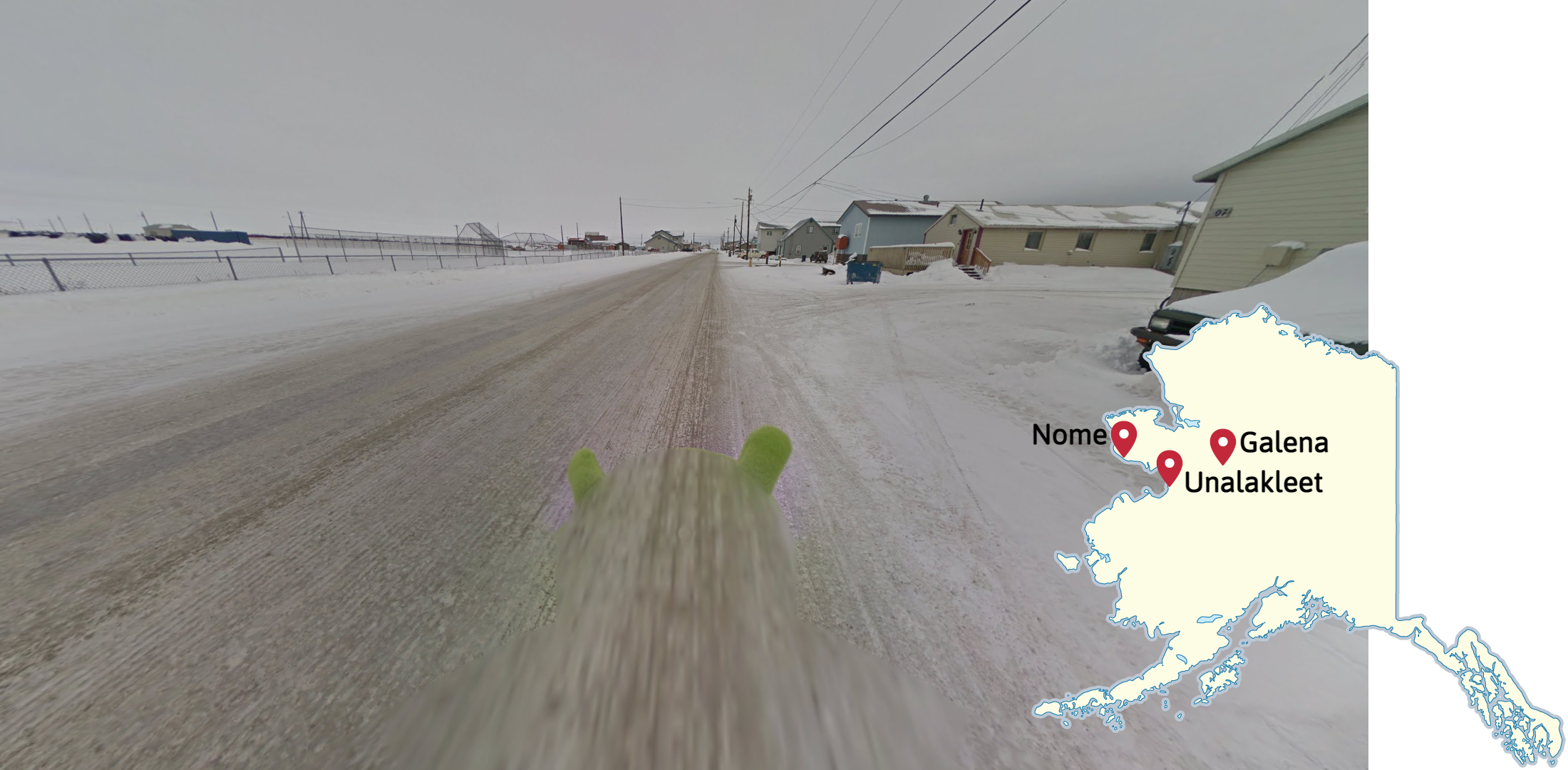
Nome, Unalakleet and Galena are three isolated Alaskan towns which are covered only by trekker. The trekker’s lime green hat or black and white beanie can be seen.
NOTE: The trekker’s black and white bandana can only be seen in Nome.