
Botswana


All of Botswana was covered by a white Google car without an antenna.
NOTE: Within Africa, this car can also be found in South Africa, Lesotho and Eswatini.

Botswana has white front plates and yellow rear plates, similar to UK-style plates.
NOTE: Botswana is the only country in southern Africa where yellow rear plates are predominantly found.

Signs in Botswana are usually in English. Most town names, however, are derived from any of the indigenous languages spoken in the country.
NOTE: The Afrikaans language, which is closely related to Dutch and common in South Africa, is very rare in Botswana. You will almost never find Afrikaans place names.

The typical Botswana landscape is dry and mostly flat, though a limited amount of elevation can be found in certain regions. Common vegetation includes shrubs, small trees, and occasionally dry, golden grasslands. The soil is arid, sandy and ranges in colour from white to red.
NOTE: The border region of South Africa can have a similar landscape.

Like the other countries in Southern Africa, outside road lines (if present) are yellow, while centre road lines are white.
NOTE: Outside yellow road lines in arid environments also exist in Israel, Palestine, Jordan, and the UAE. However, these countries all drive on the right side.
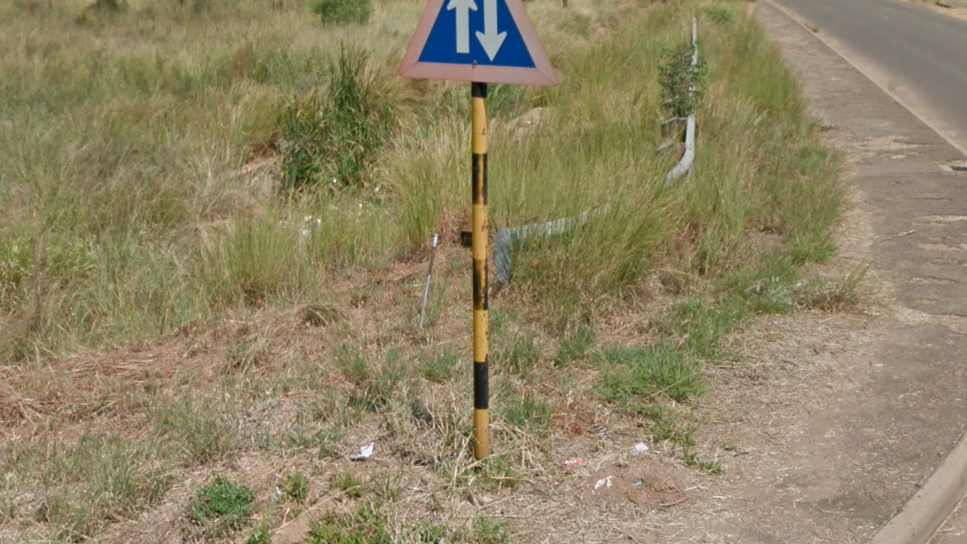
Botswana has a unique black-and-yellow striped signpost. More rarely, you can see red-and-white signposts.
NOTE: In Southern Africa, these signposts are only found in Botswana.
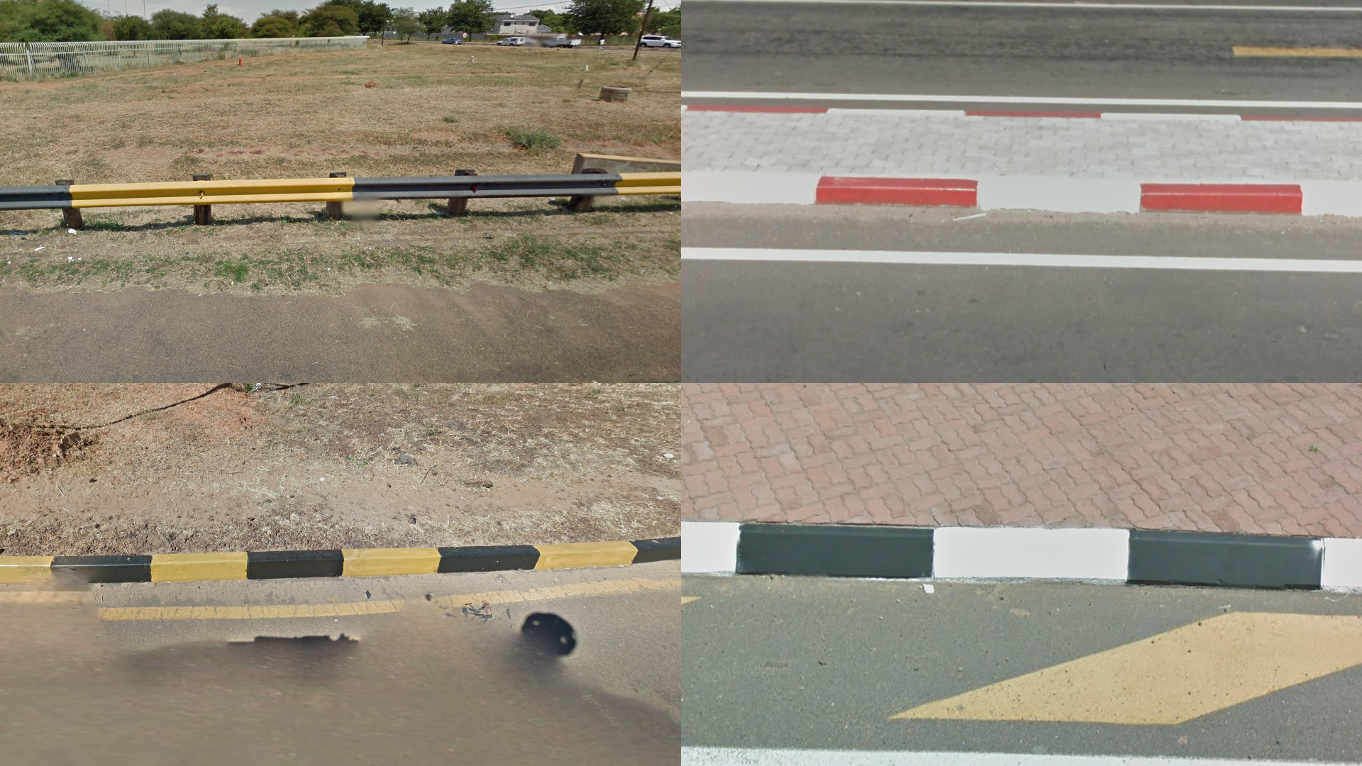
Curbs and guardrails are usually striped. Possible colour schemes are black-and-yellow, red-and-white, and black-and-white.

These small red-and-white chevrons can sometimes be found next to the road.
NOTE: They are also very common in South Africa.

Just like the other Southern African countries, direction signs have a green background.
The numbers of major roads start with A. These road numbers frequently appear on direction signs.
NOTE: Road numbers in South Africa never start with A.

Some road signs have a blue background. This is an older style of sign that was used before signs with white backgrounds were introduced. They are relatively unique to Botswana.
Note that most road signs will have the newer white background.
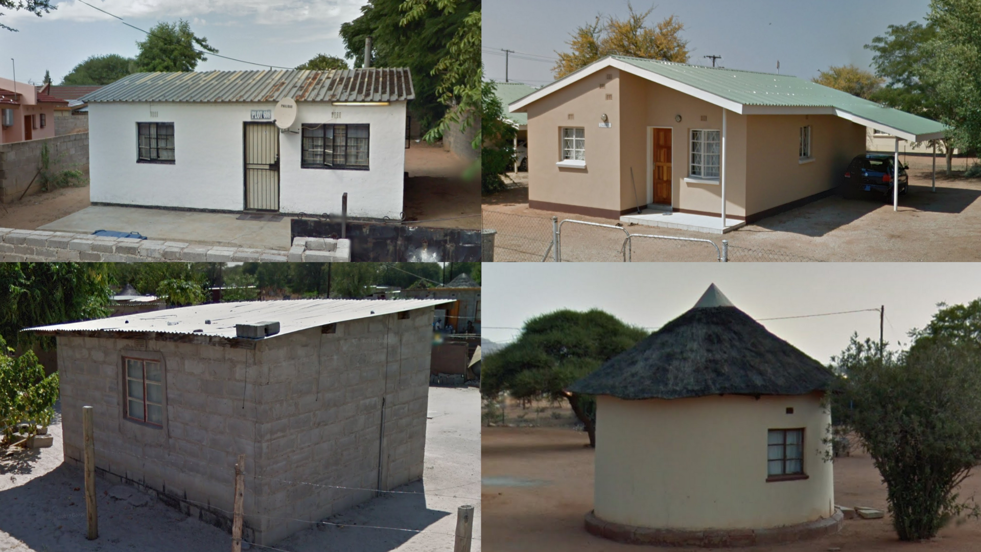
Typical Botswana houses range from small impoverished shacks to comfortable middle-class bungalows. Some buildings have exposed grey bricks. On occasion, you might find traditional round huts.
NOTE: All of these house styles are also found in the other southern African countries.
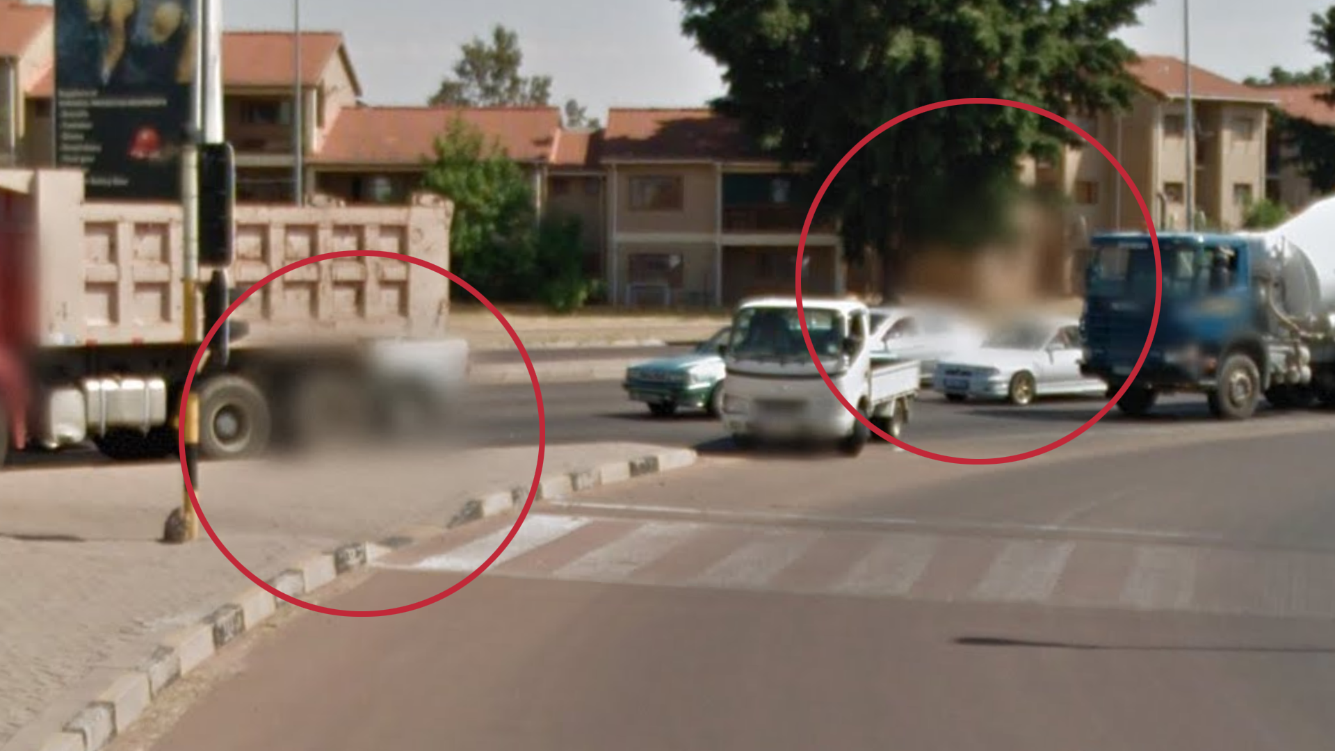
Random small blurs are common in Botswana’s coverage. These blurs are similar to the ones found on licence plates and faces, but they cover seemingly random parts of the panorama instead. This is especially noticeable in urban areas, and mostly absent on more rural roads.

Botswana has many unique and distinct regions throughout the country. This image breaks down the main factors that differentiate each distinctive landscape by soil, vegetation and other clues.
You can click on the image to enlarge it.
RESOURCE: This image was made possible by the invaluable research done by Jasper Woodard. You can check out his Botswana videos on his YouTube channel.

Coverage in Botswana is fairly limited due to the country’s sparse road system. In addition to regular paved roads, you can still expect to see some rural unpaved road coverage. The most dense coverage is in the east and near Gaborone. The larger towns have extensive side road coverage.

This map shows which covered roads are paved, and which ones are unpaved. It is slightly simplified for ease of reading. Small, unpaved side roads in and near towns are not shown.

Most of Botswana is as flat as a pancake. However, every now and then you will find some elevation. If you see hills, you are most likely in one of the two areas indicated on the minimap.
NOTE: Even in the indicated areas, there are a lot of very flat areas, as many of Botswana’s hills are geographically isolated. Some lone hills may also appear far outside the indicated areas.

The southeastern region near Gaborone has many semi-arid hills covered in short shrubs. If you see a lot of these, you are likely to be in the area between Gaborone and Lobatse.
NOTE: Similar hills can be found elsewhere in the country and across the border in South Africa. If you see a large quantity of them, and use other clues to rule out South Africa, you can be fairly certain that you are in southeastern Botswana.

The landscape in the eastern pocket north of Francistown is characterised by red soil and a somewhat arid look. The soil in these two areas often looks firm and rocky, rather than sandy or dusty. Trees and bushes with yellowed leaves and other “autumn” colours are common. Many trees are bare and withered. You might see fallen leaves on the ground here and there.

A large region in the middle western part of the country is characterised by very white sandy soil. In addition, the vegetation tends to look very dry.
NOTE: Sandy soil can be found in many places in Botswana. This tip specifically refers to the bright white colour of the sand.

The A35 is a very recognisable road: there is always a power line to your west. It can also be recognised by its grainy asphalt with faded markings. Many small tracks can be found parallel to the road, disappearing into the bushes.

The A33 is characterised by a landscape that is more lush than usual. Trees have lots of green leaves and the grass is very tall. The more north you go, the more lush the vegetation becomes.

The road that runs along Botswana’s southern border, through the town of Middlepits, has asphalt with a distinct red tint. The landscape is arid. In some sections, slight hills can be seen.
NOTE: Near the town of Middlepits itself, the soil is very red and dotted with small white pebbles.

Gaborone is the capital and largest city. It tends to look richer and more developed than the rest of Botswana, though some neighbourhoods may still look impoverished. In some southern parts of the city hills can be seen, but most of the town is flat.
NOTE: The only other place in the country that often looks similar is Francistown.

In Francistown, you can often see a lone hill with radio antennas, which is located on the north side of the city. This hill is a good way to distinguish Francistown from Gaborone.
NOTE: The town of Serowe has a similar hill with antennas. Here, the towers are taller, red-and-white striped, and the hill has a flat top.

Maun is the only relatively large city in Botswana that has this bright white sandy soil, which is typical for the middle western region of the country.

The western part of the A2 has overcast coverage, making it recognisable.
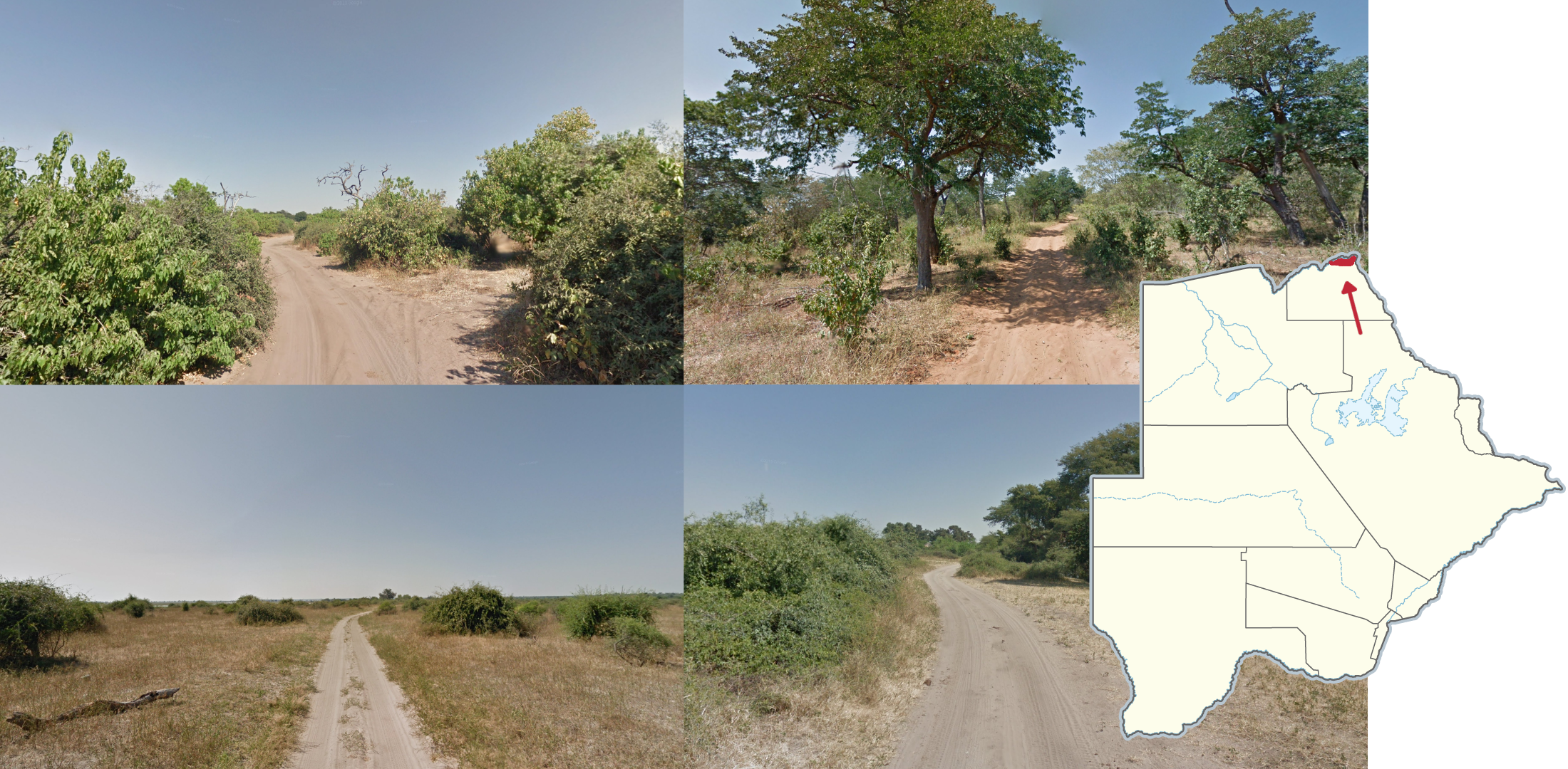
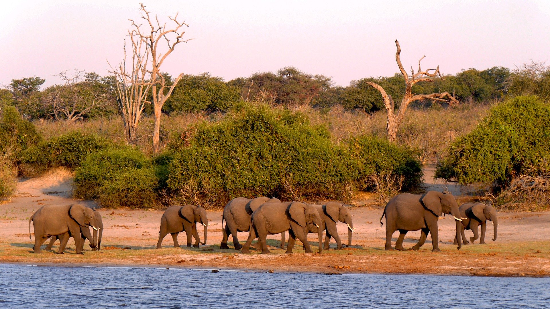
Chobe Flood Plains National Park in the far north has a lot of small, winding dirt road coverage, with a lot of it being just south of the Chobe River. It has scattered lush bushes on either side, and you will often find wildlife such as elephants and warthogs.
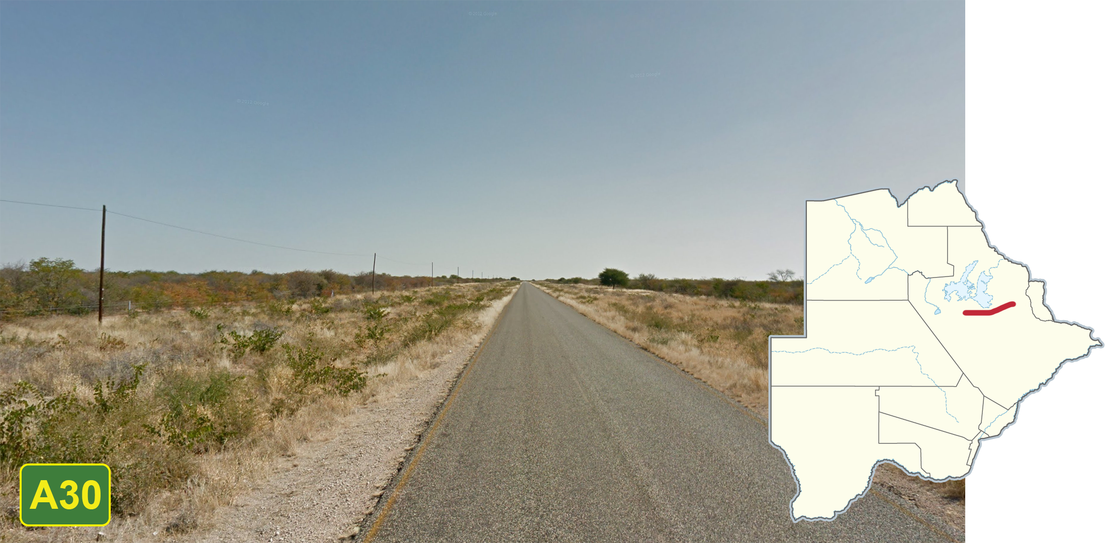
This portion of the A30 has a distinct autumn feel unique to it. Notably, there are trees with orange coloured leaves lining the road in straight rows. In addition, there is often tall grass as opposed to other autumn looking locations.

Salt pans can be found in central-eastern Botswana. Dirt road coverage can be found leading to the pans and has similar soil and grass, but you can also find many trees along the road. They are mainly found around the Nwetwe pan. The salt pans show up as lakes on the map.
NOTE: A lot of the dirt road coverage near the pans was taken in June, and will feature trees without leaves or those that are beginning to lose their leaves.

Just outside Gaborone, there is a lot of coverage along very rural, small dirt tracks. They can be identified by the orange-red shade of dirt and abundance of green trees and bushes surrounding the road.

The section of the A33 within the Sibuya Forest Reserve and the CT/3 (Tamafupa) Commercial Wildlife Utilisation is under construction. This is most visible by the service road or embankment alongside the road.
NOTE: Despite being in the construction zone, some locations may still look normal.

The mostly unpaved road north of Maun to Khwai can be identified by extremely white sandy soil and tall green trees surrounding the road. The first section of the road, between Maun and Shorobe, is paved. But that section can still be identified by the trees, faint road markings, and power lines to the west of the road.

The A20 has mostly clean, recent asphalt. Some sections of the road are much thinner than usual. The landscape is characterised by red soil, dry grey-coloured trees, and very little grass

Southeast of Tshabong, the A20 has been recently repainted and has very bright yellow lines and relatively dark asphalt. There is a powerline running alongside it to the northeast, it has orange-tan sandy soil, and you can often find patches of yellow flowers.

The Tsodilo Hills World Heritage Site is memorable due to its large protruding hills with exposed rock faces. The coverage around the hills is entirely on dirt roads.

These distinctive silos are found in Pandamatenga in northeastern Botswana and can be seen all around the town.