

Iceland

The Generation 4 coverage was captured with red and white pickup trucks, which have been well blurred.

The Generation 3 Google car in Iceland is a white car with a long antenna.

Icelandic licence plates are fully white with blue characters. Unlike most of Europe, the plates do not feature a blue strip on the left.
It can be hard to see the blue of the characters through the blur of the plates.

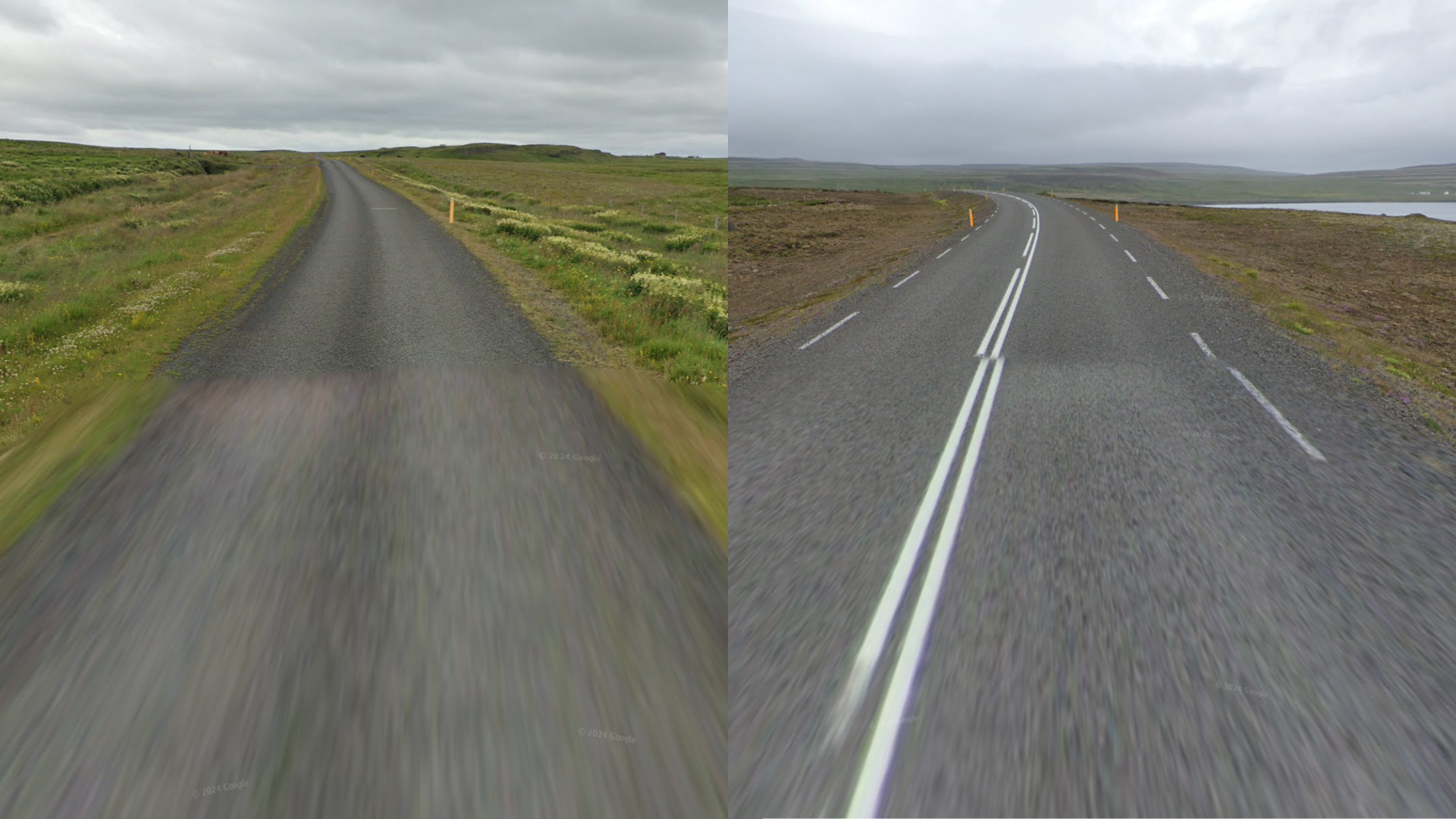
Iceland has unique yellow bollards with a white reflector. These bollards are extremely common and can be found throughout the country on almost every section of rural road.

Iceland often looks barren and treeless. Most regions have a dark grey soil consisting mostly of volcanic rocks.
NOTE: Due to the lack of trees, the landscape in Iceland does not look like anywhere else in Northern Europe.

Iceland is a very geologically active country, where plate tectonics and volcanic processes have shaped the landscape. As a result, many regions are rugged, mountainous and a sight to behold. In addition, strange and bewildering landscapes can be found all over, such as geothermal lakes, lava fields, rift valleys, and towering rock formations.
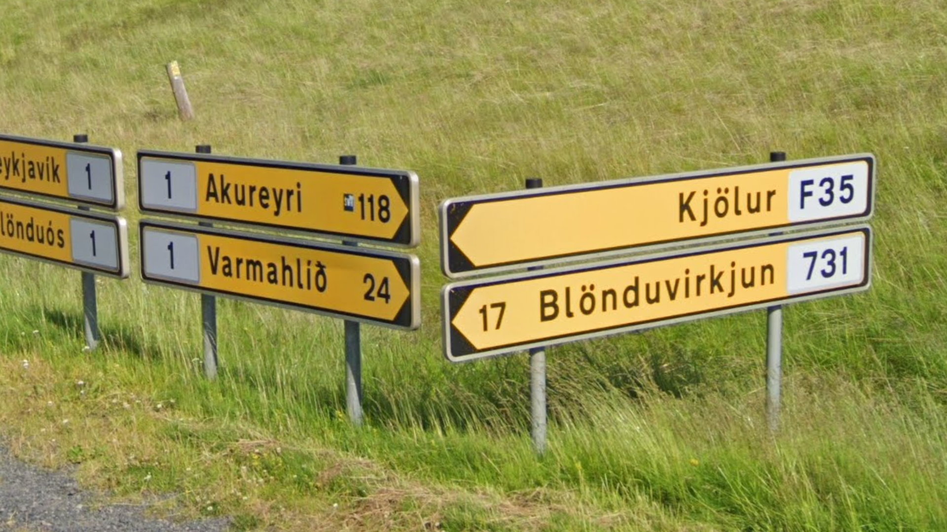
The road direction signs of Iceland are yellow. They usually have a white inset box that shows the road numbers. If the inset box has a dashed border, the number listed refers to a nearby road, not the road you are currently on.
NOTE: Direction signs for very local destinations, such as farmsteads, typically have different background colours: blue or white.

Icelandic pedestrian signs feature four stripes and often have a slight yellow tint.
NOTE: Iceland is the only European country that uses pedestrian signs with a yellow background.

The Icelandic language contains a couple of unique letters. These are some of the most recognizable ones: ð þ and æ. Vowels can have the following accents: á é í ó ö ú ý. The uppercase version of ð is Ð.
NOTE: ð is also found in the Faroese language. æ is found in Danish, Norwegian and Faroese.

Iceland’s street signs use a white background and black text. They often have a thin metal rim and are attached to lampposts or traffic lights.

Iceland has all-white road lines. Outside lines, if present, can be either solid or, more rarely, dashed lines.
NOTE: Iceland has no yellow road lines. If you see yellow road lines in a Nordic environment, consider Norway or Finland.

Icelandic chevrons are black with yellow arrows.
NOTE: Norway and Finland have similarly coloured chevrons. Sweden, on the other hand, has unique blue and yellow chevrons.

Just like Sweden and Finland, Icelandic signs feature a yellow background.

Iceland is rather sparsely covered. The southwest region has the densest coverage. Only a few interior roads are covered.
You can click on the image to enlarge it. Alternatively, you can look at the coverage in more detail on this site.

Iceland has a very sensible road numbering system that allows for quick 5k’s, provided you find the yellow direction signs that list the road numbers of the intersection you are on.
The main ring road, which circles the entire island, simply has the number 1. There are no other roads that start with 1.
The first digit of the other road numbers is region-specific. These regions have a sequential distribution around the island, starting from 2 in the south and increasing up until 9 in a clockwise direction (see map for approximate distribution).

The Westfjords region features numerous narrow fjords, surrounded by moderately tall, and mostly flat-topped mountains.

The far east of the country is also home to several fjords. What distinguishes them from the Westfjords are the generally larger and more jagged mountains.

The mountains west of Akureyri contain many valleys, sandwiched between tall, often slightly snowcapped peaks. Most of these valleys generally face north to northeast.

Barren landscapes consisting mostly of dark volcanic gravel, with little to no vegetation or signs of life, are typical of the inland regions of Iceland. Most such covered roads are located in the east.

The Southwest agricultural area in Iceland can be identified by its relatively flat farmland landscape scattered with numerous farmsteads, fields, meadows and grasslands.
NOTE: Although there are other smaller agricultural areas in Iceland, mountains in this area tend to be quite distant, making it unique.

The wide valley around Eiðar is slightly hilly and agricultural, with tall, snowy peaks visible in the distance on either side, to the east and northwest, respectively.
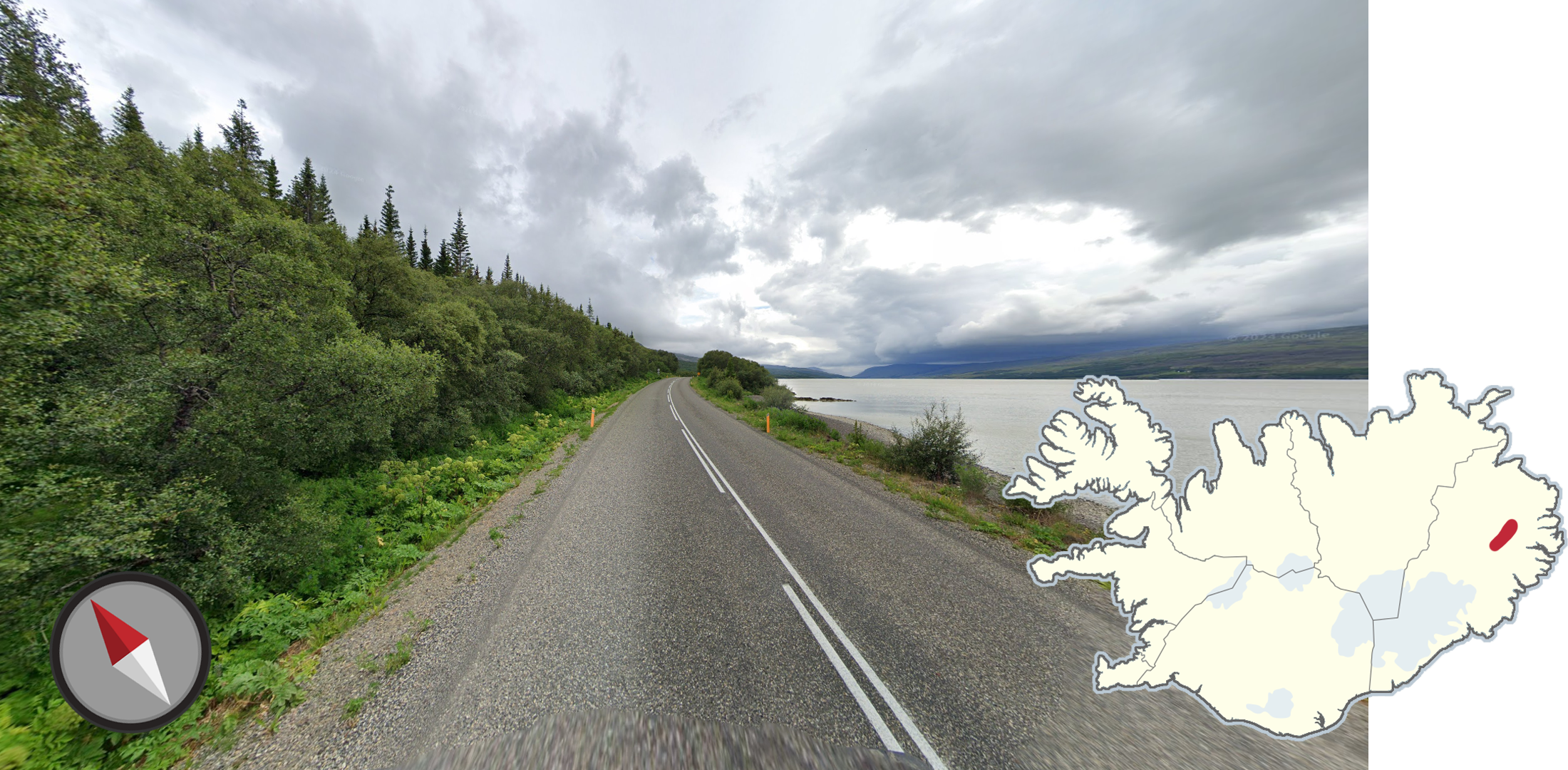
The valley around Hallormsstaður has a distinct northeast/southwest angle with low-lying mountains on either side, a wide river flowing through it, and an unusual amount of trees for Iceland. Some of the sideroads are in the forests.

You can recognise the area near the town of Selfoss from its distinct flat-ridge mountain. Due to the otherwise flat landscape, this mountain can be seen from a wide area.
Cities

Reykjavík is the capital and by far the largest city in Iceland. The city is mostly flat with slight hills, and is located on the south side of a bay. It is most recognizable as it is significantly larger than other Icelandic cities, with a large urban area and “bigger city” feel.
NOTE: The city of Akureyri can feel urban in some places. You can distinguish it from Reykjavik as it has mountains to the east and west.

Car Meta

Iceland can be split in half depending on the colour of the pickup truck, with red being found in the southwest, and white being found in the northeast.

The southern coast of Iceland features some impressive glaciers visible from the ring road, spilling into the sea from the Vatnajökull ice cap.

There are only a handful of highways in Iceland which are either divided or have more than two lanes. The divided highways are shown in dark red, while the highways with three or more lanes are shown in bright red.
NOTE: There are two exceptions to this:
Divided roads can be found inside cities other than Reykjavík.
Roads may temporarily be divided close to intersections.

The Island of Heimaey can easily be recognised by seeing these ragged rocky cliffs overlooking the town of Vestmannaeyjabær. Similar cliffs can be seen on the islands off the coast.

Very foggy coverage can be found around the town of Bakkagerði, in northeastern Iceland. The fog can also be seen from a distance.