
Serbia


Serbia has a few bollard designs, however most of them will have an off-centred reflector. The bollards are usually flat, with no depth to them.

Serbia uses B-Profile guardrails exclusively.
NOTE: North Macedonia does not use B-Profile guardrails. For a good overview of European guardrails, see this infographic.

Serbia uses chevrons with a black arrow on a white background.
NOTE: Within Europe, these chevrons can also be found in Slovenia, Montenegro and North Macedonia.
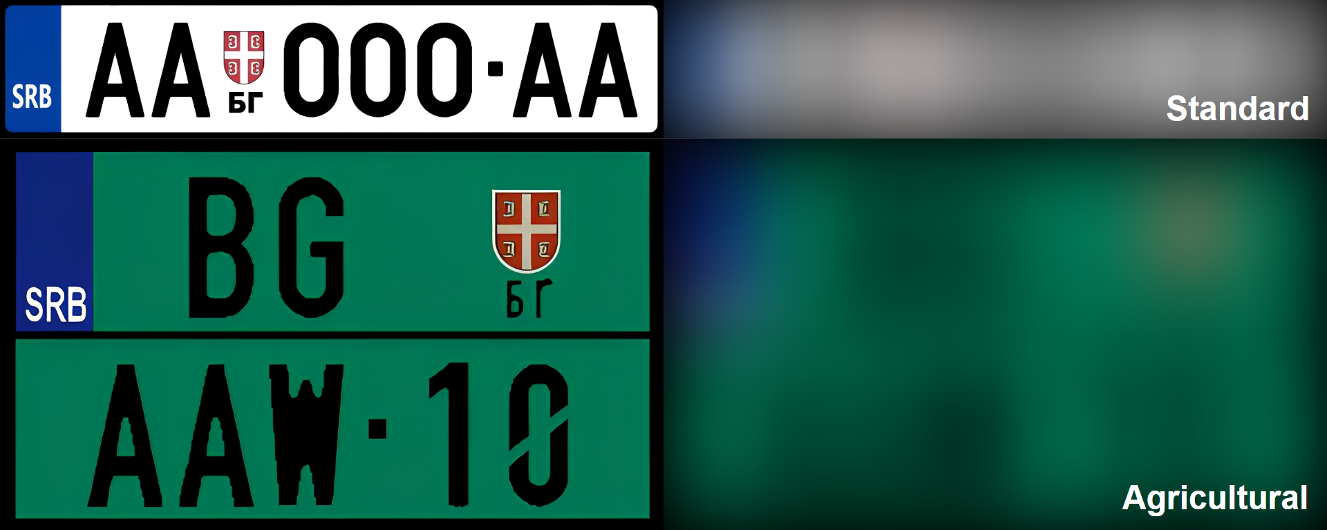
Serbian licence plates are white with a blue strip on the left. Agricultural plates, on vehicles such as tractors, are green.
NOTE: Croatian and North Macedonian plates typically do not have a blue strip.
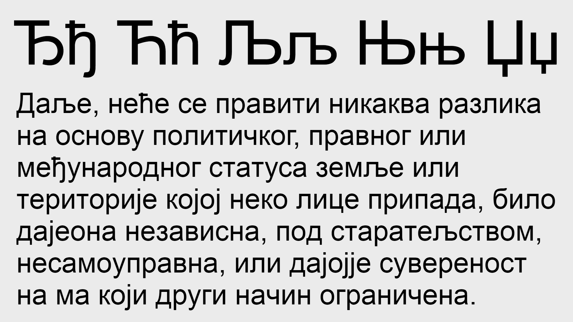
Serbian is a Slavic language which uses both the cyrillic and latin script. These letters are unique to Serbian:
Ђ ђ
Ћ ћ
These letters are found in Serbian and Macedonian:
Љ љ
Њ њ
Џ џ

When written in the latin script, Serbian uses the special letters Č, Ć, Đ, Š and Ž. Note that all of these letters may also be found in Croatian and Montenegrin.

Most of the coverage in Serbia was taken by a Google car with no antenna.
NOTE: Other than North Macedonia, almost all of central and eastern Europe has antenna coverage in Generation 3.

This is a coverage map of Serbia. Most of the coverage is in the north in Vojvodina, around Belgrade and in the southeast around Niš. Kosovo does not have any coverage.
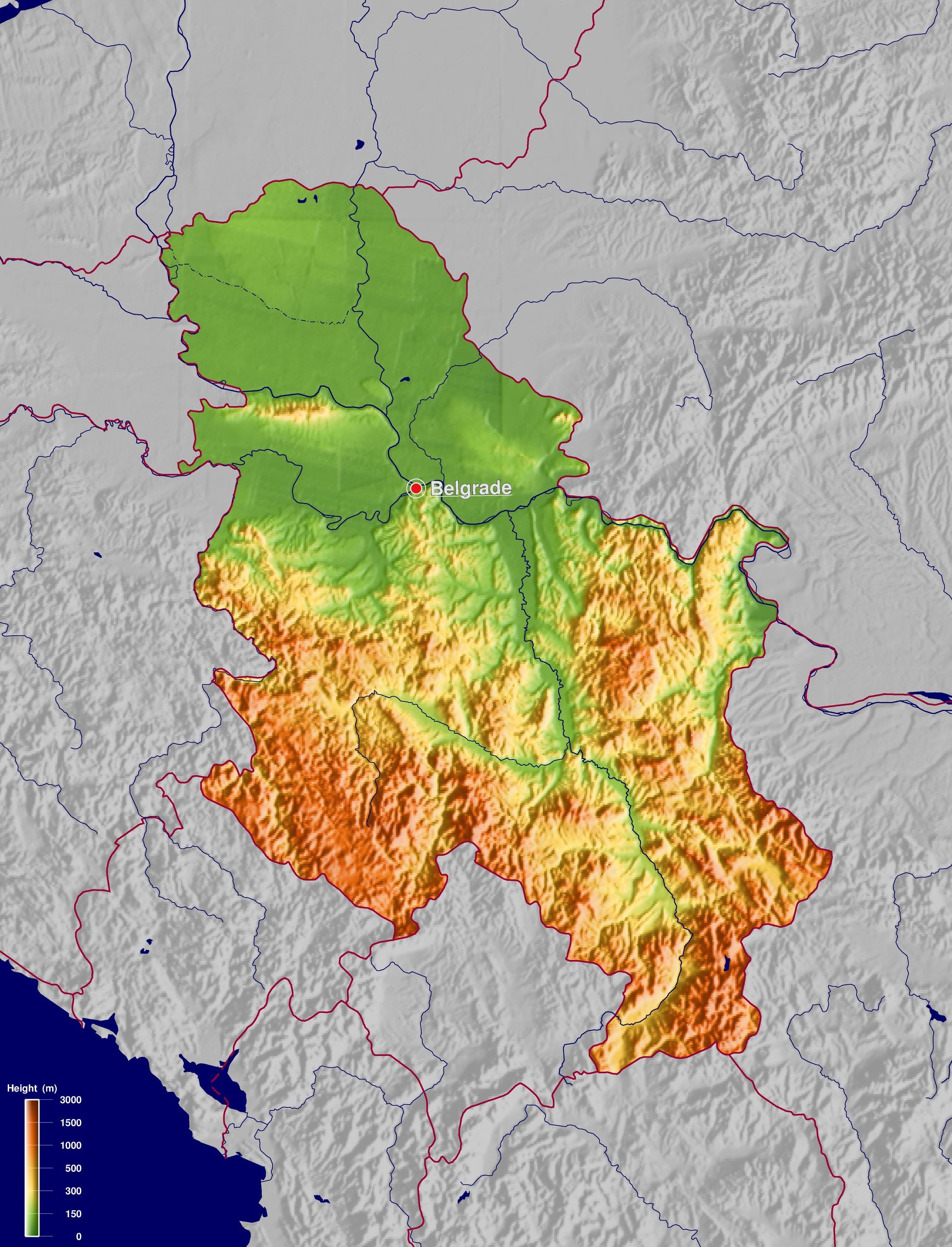
In the north of Serbia in the Vojvodina region, from the Hungarian border to Belgrade, the landscape is extremely flat, with no hills whatsoever. A slight ridge however can be seen at Fruška Gora National Park.
A more hilly landscape can be seen in the central-southern region. The most mountainous regions of Serbia are found in the southwest and southeast, where the Dinaric Alps, Carpathian and Balkan mountains run through Serbia.

Serbia uses 2 digit area codes, with the first digit between 1 and 3. Area codes starting with 2 are found in the north, area codes starting with 1 are found in central and eastern Serbia. Area codes starting with 3 are found in the south-west.

Vojvodina, the northern region between the Hungarian border and Belgrade, can be recognized by the flat, agricultural landscape. The landscape will be completely flat with no hills whatsoever.

This slight ridge in an otherwise flat landscape can be seen in Fruška Gora National Park, southwest of Novi Sad.

Central-northern Serbia can be recognized by the slight rolling hills.

A similarly rolling landscape can be seen in the southern Morava River basin, however larger hills and mountains can be seen.

A lush, green, mountainous landscape can be seen in the south and southeast, along the Bulgarian and Kosovo border.

Fall coverage can be seen in this region south of Čačak, and a small area around Valjevo.

There are 3 main divided highways in Serbia:
The A1, or E-75 from the Hungarian border to south of Leskovac, running through Novi Sad, Belgrade and Niš.
The A3, or E-70 from the Croatian border to Belgrade
The A4 which branches off of the A1 north of Niš, to just before Sicevo Canyon Nature Park.
NOTE: Although Google maps shows that a highway is divided, it may not be divided on street view since the coverage was taken before the second carriageway was constructed. This map shows all the divided highways currently visible on street view.

A white Google Car with a short antenna can be seen in Novi Sad, Kovilj, in and around Belgrade, Niš, and the E75 connecting them.
NOTE: The white car is not always visible.

The distinct Vršac Mountains can be seen east of Vršac near the Romanian border. The mountains protrude out from a flat landscape and vineyards can commonly be seen to the south of the mountains. The Vršac Castle can also be seen atop the mountain.

Bilingual signs with Serbian alongside Hungarian can be seen in northern Vojvodina, where there is a Hungarian majority.

This tadpole-shaped smudge can be seen east of Belgrade, from just west of Bavanište to the Romanian border.
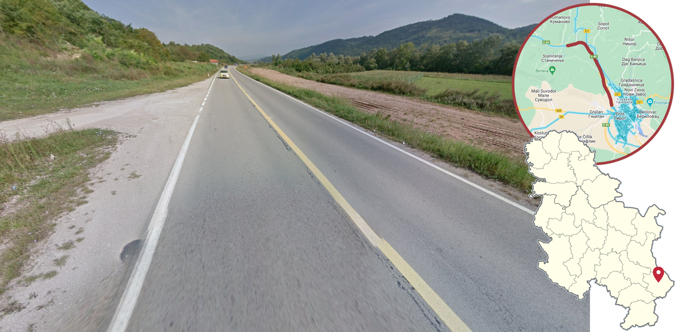
A small section of the E-80 north of Pirot has yellow centre lines.