

Singapore


Singapore is a highly developed city-state, characterised by an overall cleanliness and orderliness.
Main roads are often divided, and commonly feature black-and-white curbs and double yellow outside lines. You will often see tall apartment blocks nearby.
NOTE: In many cases, this “general look” is all you need to easily identify Singapore. Nevertheless, we have listed some more specific tips below.

All street name signs in Singapore follow this unique format. They are green, with rounded edges and a distinct white font.

Most Singaporean licence plates are black, with white text. Occasionally, you will be able to see the British style white-and-yellow plates and very rarely red plates.
NOTE: Neighbouring Malaysia and Indonesia also use black plates with white text. However, the letters will usually be divided into two or three sections - this is not the case for Singaporean plates.

Directional signs are also green, with white letters and English writing.
NOTE: Expressways each have a three-letter code (e.g. TPE), making them easy to spot on signs.

Road signs in Singapore are unique in that they are always set on a square white background.
NOTE: Road signs in almost all other countries will not have this square background.

Rain trees are seen all around Singapore, and are often planted along main roads.

Warnings are often written on the road in large letters, such as the famous “HUMP AHEAD”.

Singaporean buses are mostly lime-green, making them easily recognisable. Other designs can also be found, for example the white-and-purple SBS Transit variants.

Moreover, all bus stops are protected by concrete bollards with unique black-and-yellow warning bands.
NOTE: Similar, but not quite identical designs are found in some Malaysian cities.
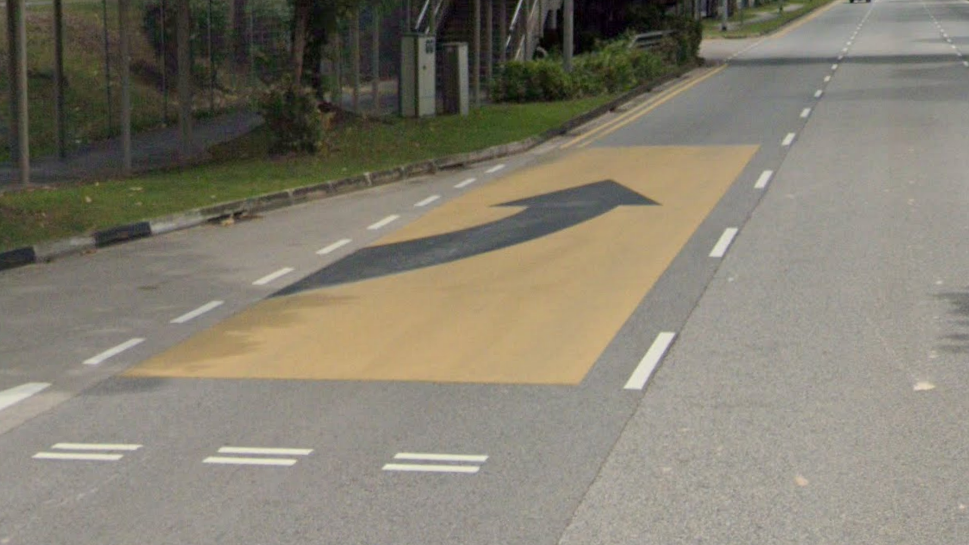
In addition to the concrete bollards on bus stops, Singapore sometimes has a unique and yellow bus-leaving box with an arrow on the street.

Almost all Singaporean traffic lights follow this design and are supported by a curved sheet of metal containing several holes.

Many streets are named after the neighbourhood they are in, especially in the suburbs.
NOTE: These neighbourhood names appear very quickly on the map, so you can save yourself a lot of time scanning for 5k’s that way. For example, the sign in the image refers to Street 31 in the neighbourhood of Ang Mo Kio.

The Tuas planning area is an industrial area that is characterised by straight roads, industrial complexes, cranes and shipping containers, making it recognisable.

You can easily recognise the island of Sentosa thanks to the green signposts, winding roads and general resort feel. Occasionally you might see a green lane like this as well.

The Generation 3 trekker on Pulau Ubin can be identified by the unusually rural forest coverage and the camouflage-type hat sometimes visible when looking down.

You can recognise St John and Lazarus Islands thanks to the Generation 3 trekker, the smooth asphalt roads and the sea almost always nearby.

The miniscule Kusu Island is easily identifiable because of the red paving stones used for the entire pathway.