
Sweden

Each administrative region in Sweden has at least one, and in many cases several, bus stop signs which are unique to that region.
You can click on the image to enlarge it.
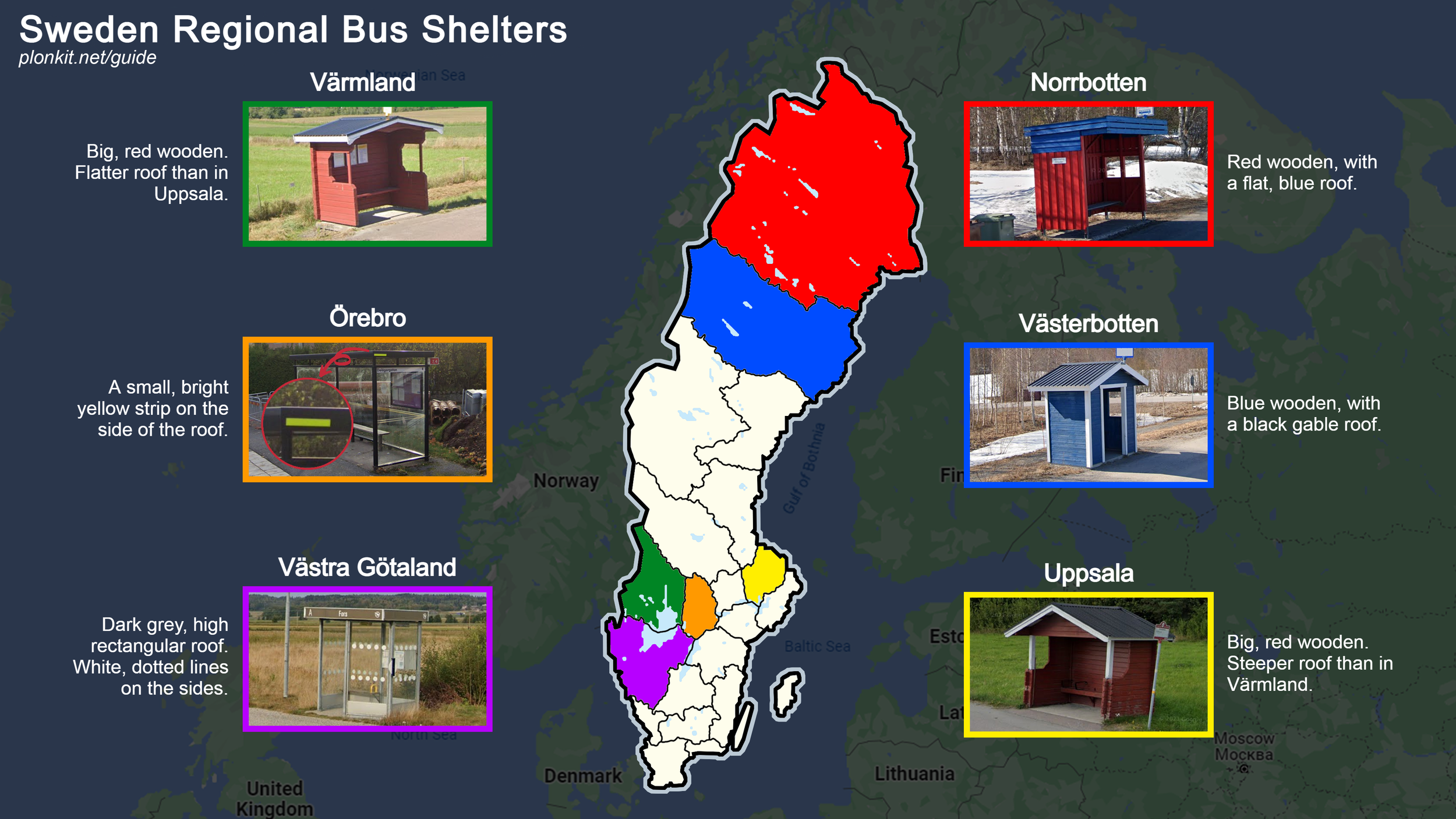
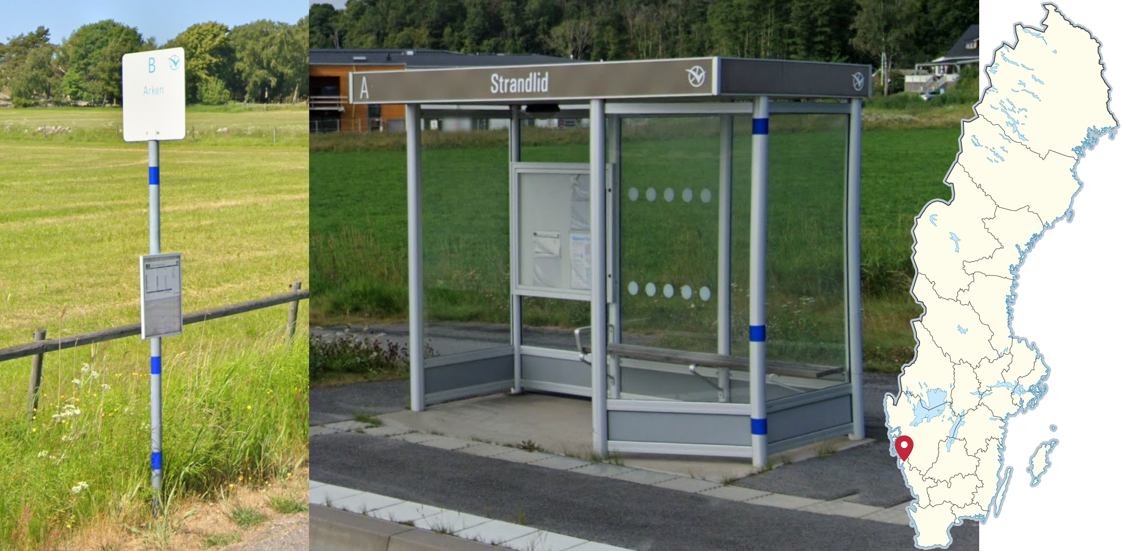
Many regions have their own distinct type of bus shelters, which may either replace or complement the bus stop signs. This image contains the ones which are most common and easily recognizable.
NOTE: Every region has multiple types of bus shelters, these are simply the most common.
You can click on the image to enlarge it.
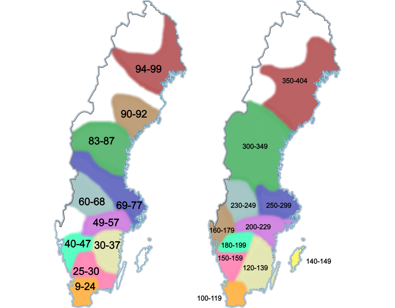
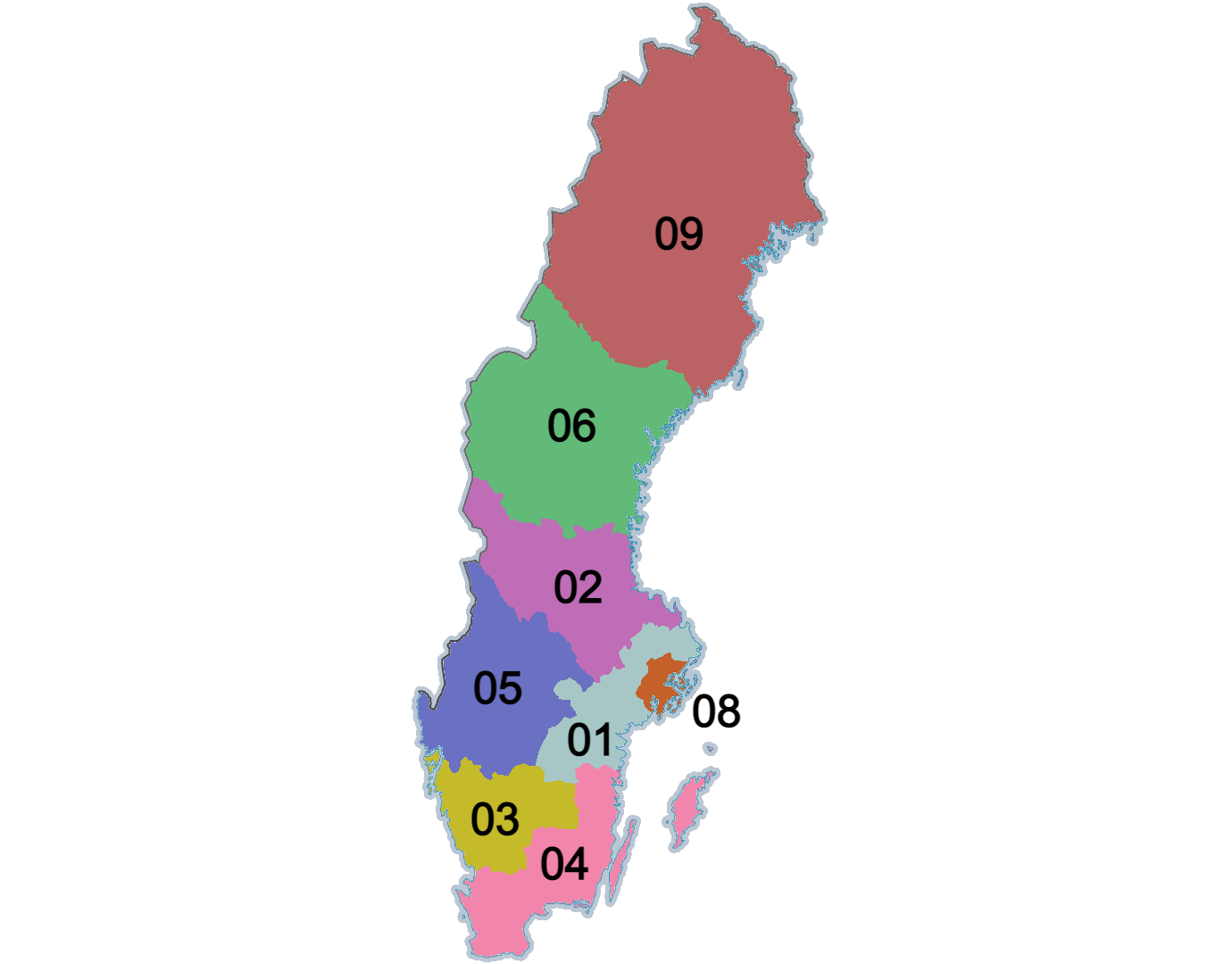
Besides the European highways, there are two types of numbered roads in Sweden, national roads (9-99) and regional roads (100-404). Numbers typically increase the further northeast you get. These maps are only approximate, since some roads go across many of the regions shown.
You can click on the image to enlarge it.

Small red crosses marking snowmobile trails can be found throughout the northern half of the country.

Many roads in western Dalarna and nearby regions have a very noticeable red colour.
NOTE: Forests in the region predominantly consist of thin pines, which, in combination with the red roads, is a very good indication of the region.
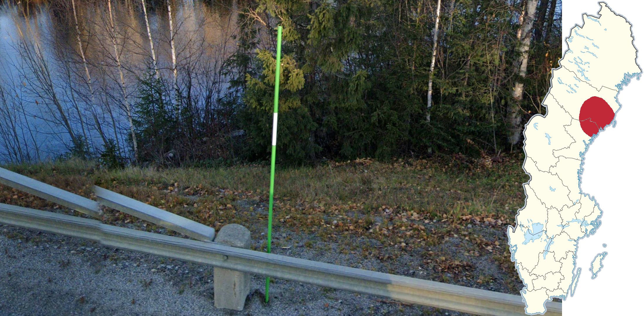
Green snow poles can occasionally be found in the area surrounding Umeå.
Wedge-shaped bollards, similar to those found in Germany, are most common in the southern regions of the country.
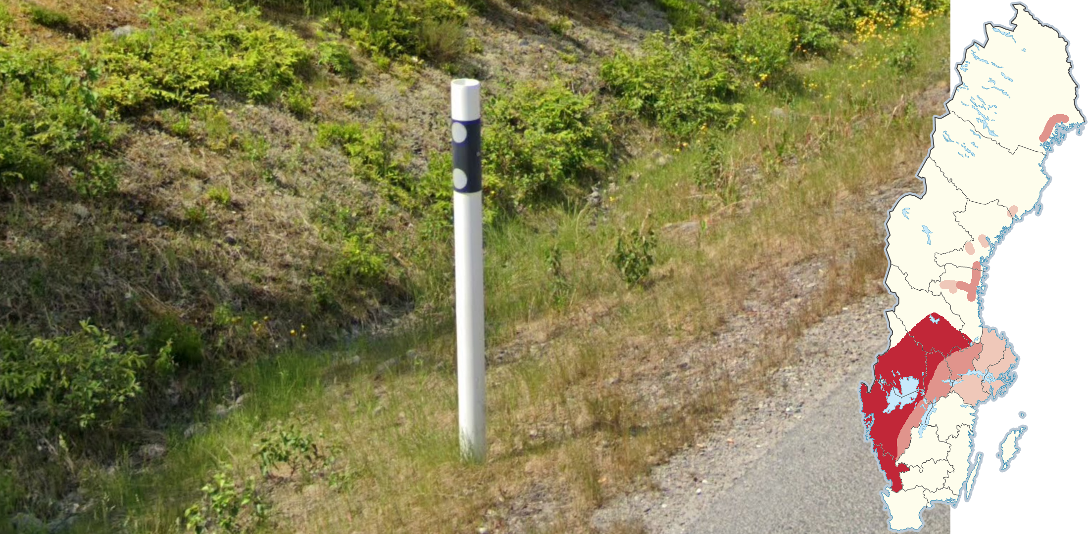
Cylindrical bollards, with a completely horizontal black section near the top, are most commonly found near the west coast and in Värmland and southern Dalarna.
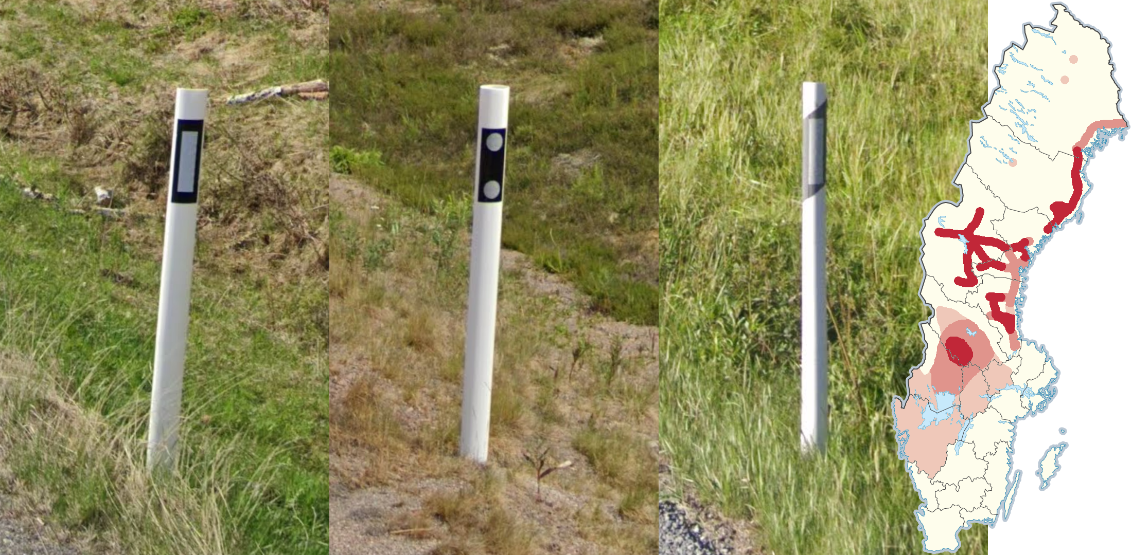
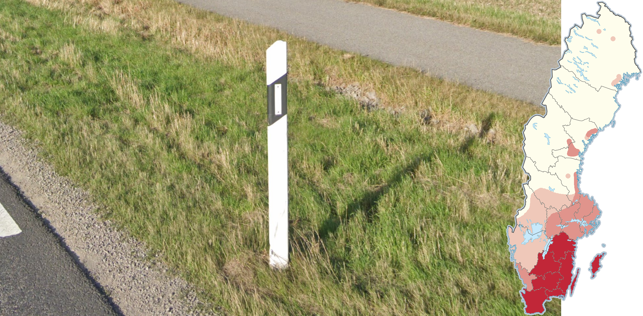
Flat bollards, or cylindrical bollards with a black rectangle containing the reflector are most commonly found on major roads in the northern half of the country.
Beware that one type of flat bollards can look similar to the cylindrical bollards from the last tip, however the black section here is not horizontal.
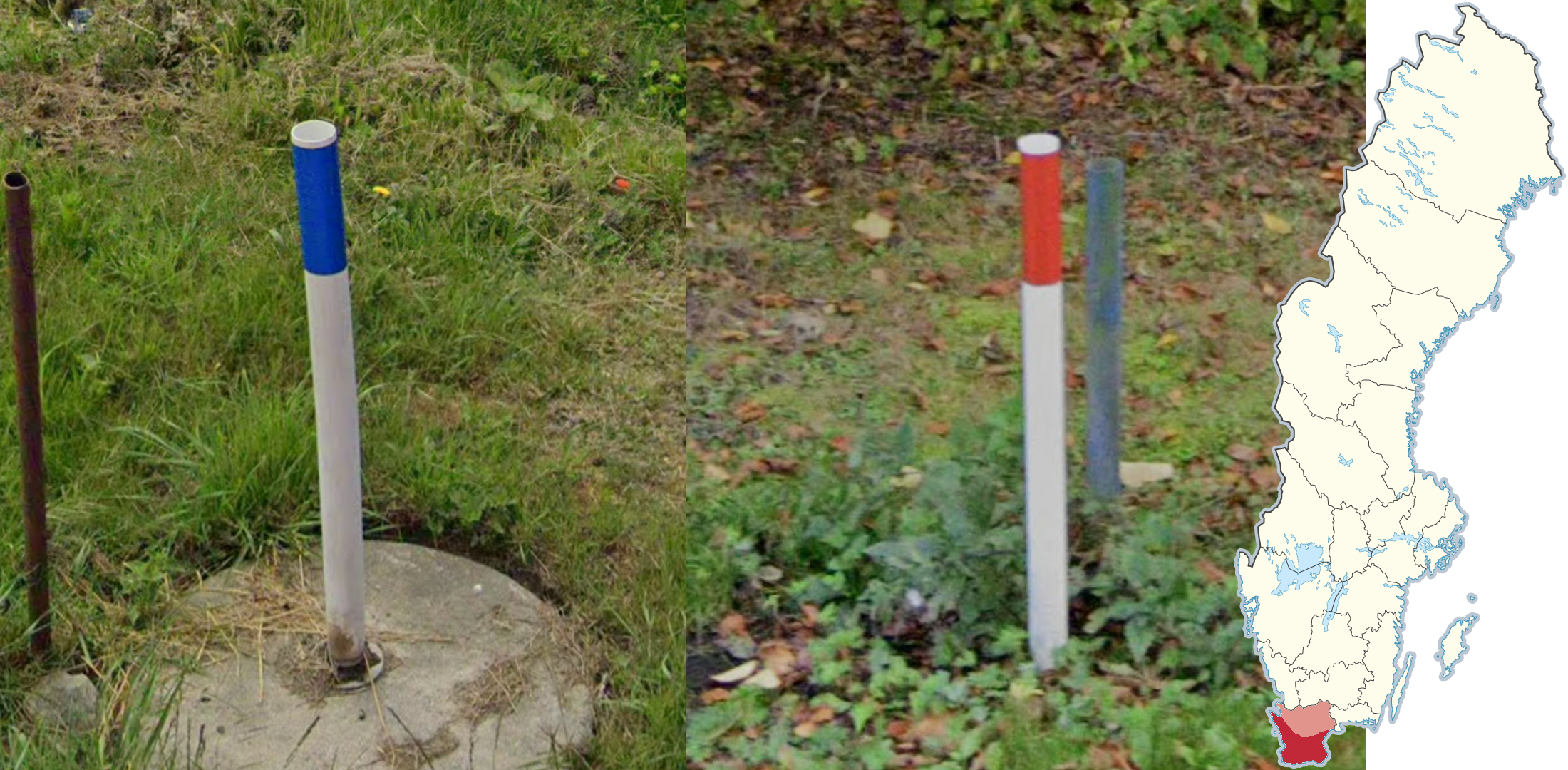
These small white bollards with either a blue or a red strip near the top can be found in the countryside of Skåne.
NOTE: You may occasionally find similar bollards in urban areas further north.
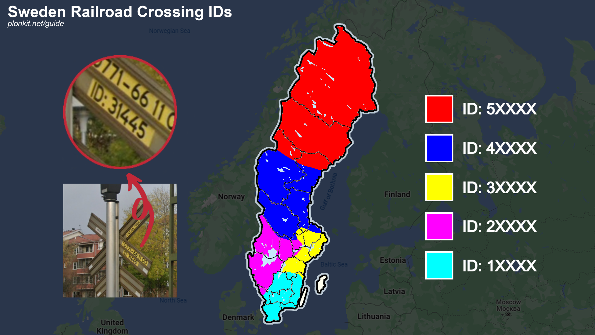
The backside of railway crossing signs have a yellow sticker with a 5-digit ID number. The first digit indicates the region, and it predominantly increases to the northeast.
NOTE: The first digit may also be a 6, which can be found randomly throughout most of the country.
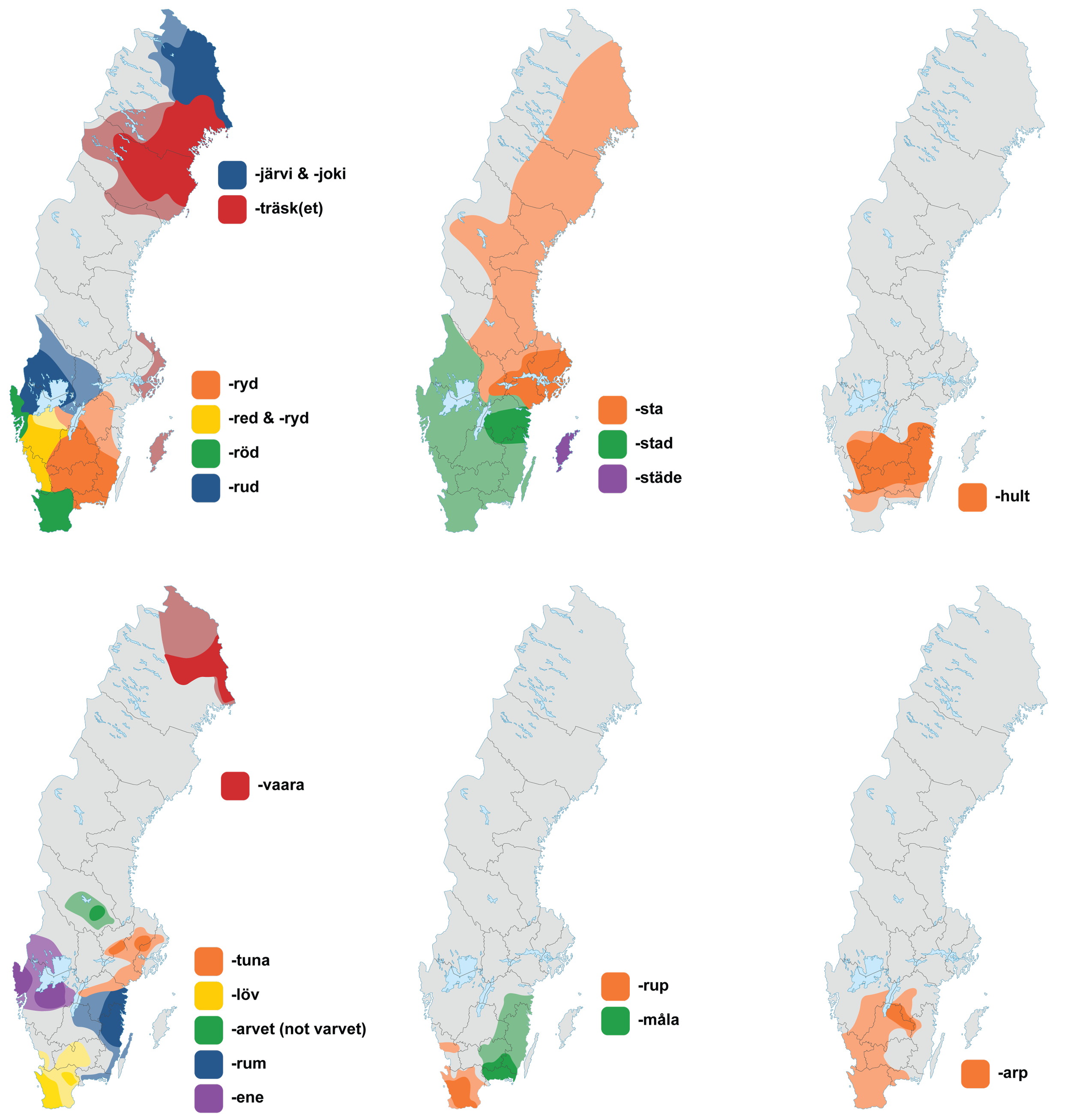
Some place name endings are limited to a certain region. This map shows some common and useful endings.
Place names are not limited to just villages and towns: local farmsteads and other geographical points of interest are also included.
The distributions shown on the maps are not 100% definite. Some exceptions exist.
You can click on the image to enlarge it.
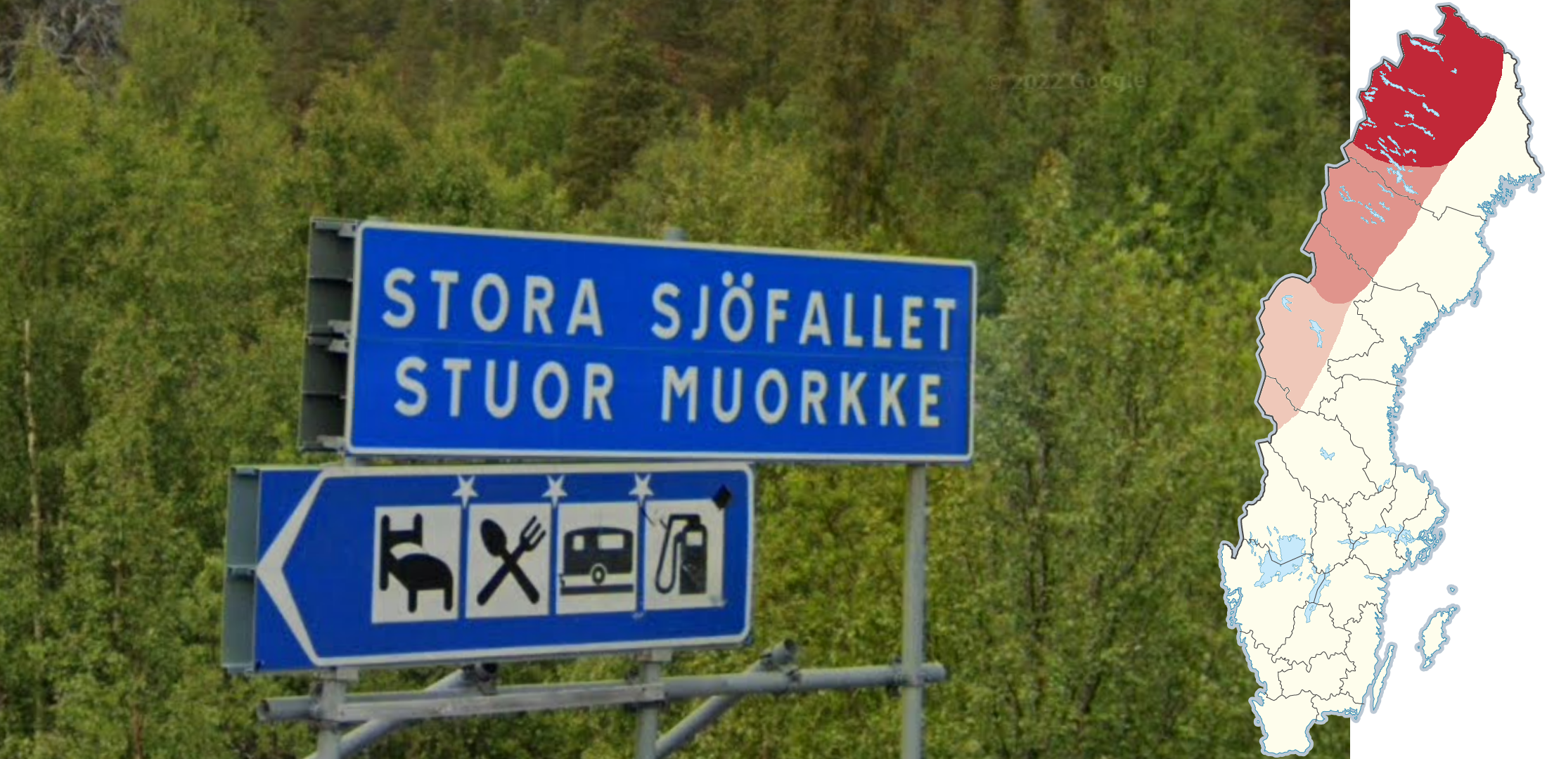
Sámi bilingual signs can be found inland in the northern parts of Sweden.
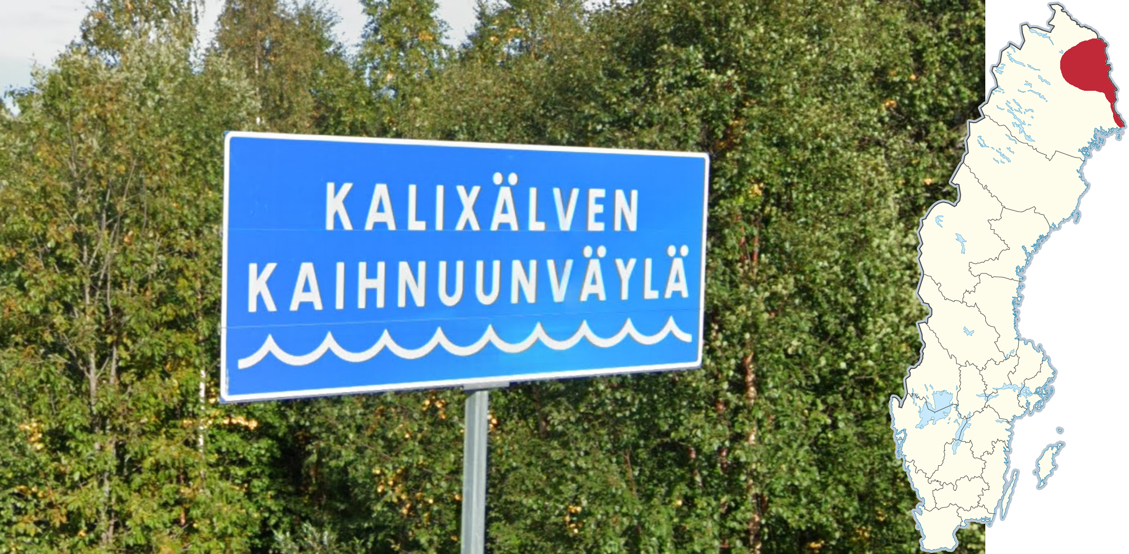
Meänkieli is a language closely related to Finnish, which is found close to the Finnish border. One of the most common occurrences on signage is for river names, which will end in “väylä”. It is also possible to find trilingual signs with both Meänkieli and Sámi.
NOTE: As a general principle, if you encounter Finnish sounding place names, you are also likely to be fairly close to the Finnish border.
On Gotland, you may notice a slight green blur in the Generation 3 coverage.
NOTE: A similar blur can be seen elsewhere, most notably in Estonia.
Along the Swedish west coast, and in Skåne, you may find a white Google car with a blue stripe on the back.
NOTE: This car is almost never found outside of Sweden.
The first 3-4 (2 in Stockholm) digits of landline phone numbers in Sweden are the area code. The map shows the first two digits in every region. Within the regions, the third and fourth digit of area codes typically increase to the northeast.
NOTE: Mobile phone numbers always begin with 07.
You can click on the image to enlarge it.
Landscapes
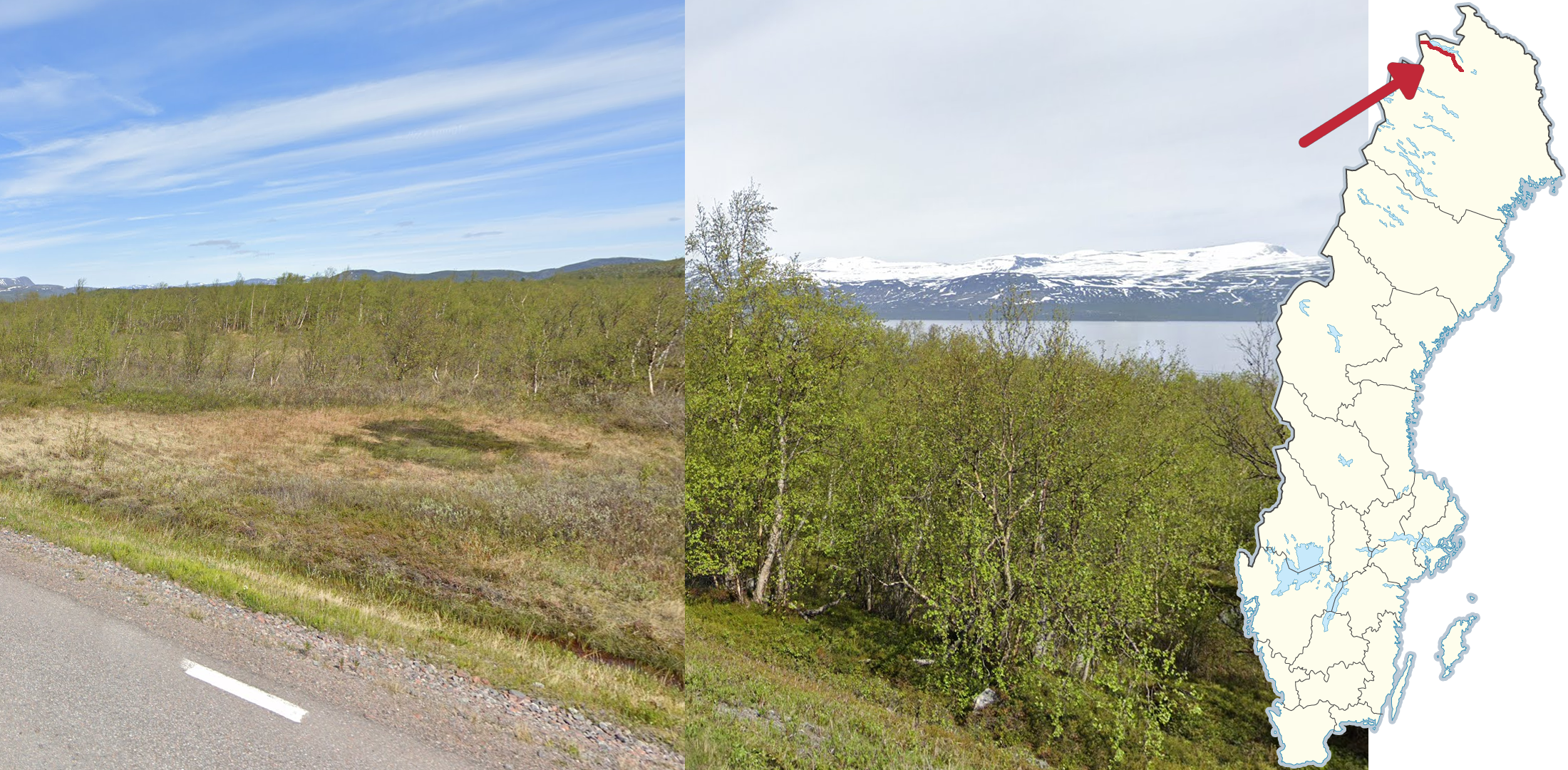
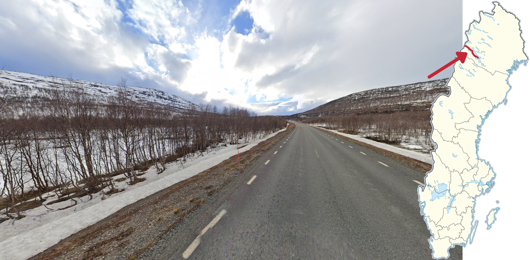
The E10 between Kiruna and the Norwegian border is a major road which can be recognised by the vegetation mainly consisting of small birches, occasionally with some pines strewn in, combined with snow covered mountains, which can typically be seen in the distant west close to Kiruna, and in all directions when you approach the border. A major lake can also be seen to the north on the western half of the road.
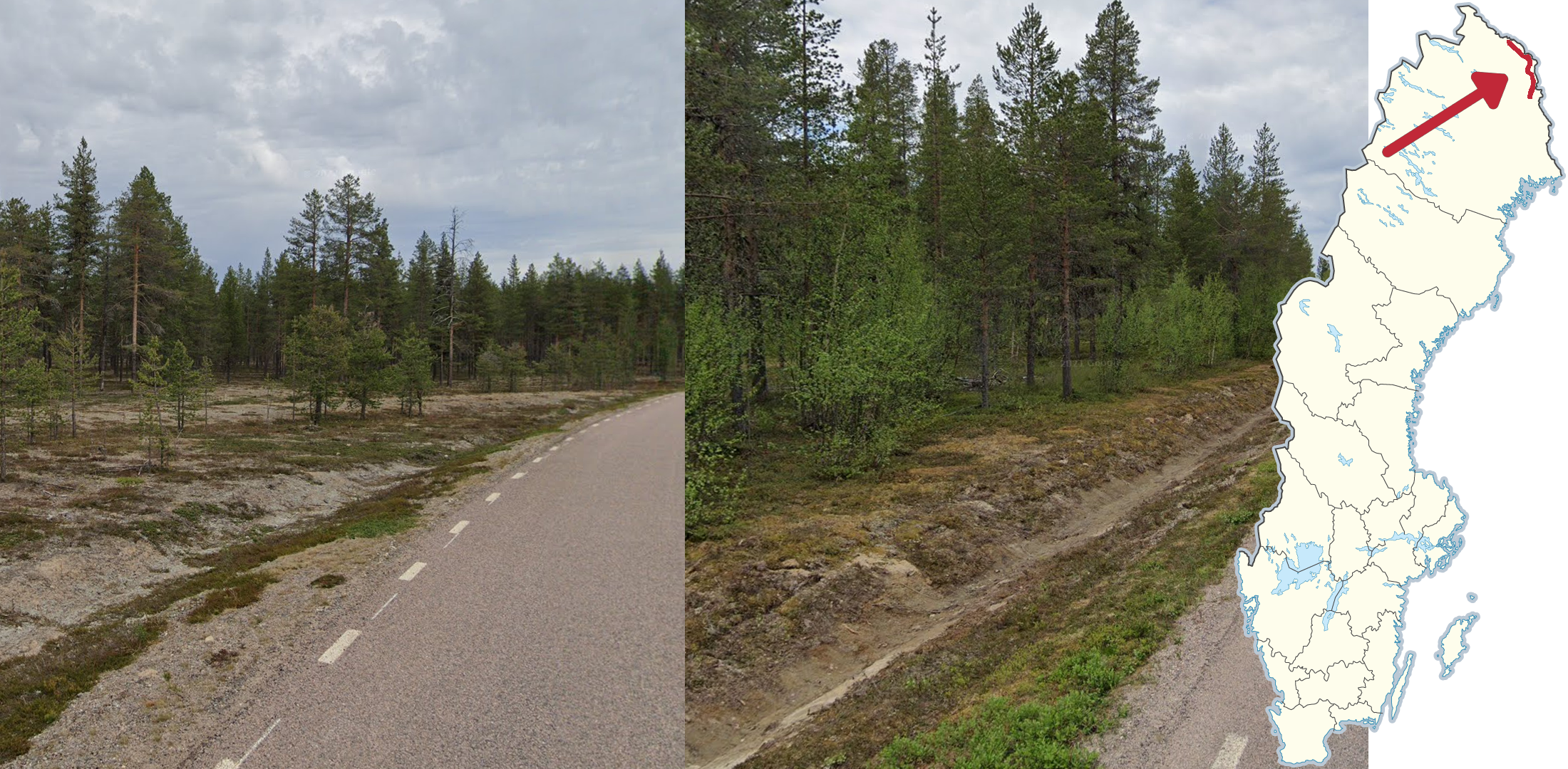
The northern section of road 99 can usually be recognized by its grey sandy ground with brown-green moss, the noticeable ditch following most of the road and its fairly low, dense forest with a mixture of birches, pines and spruces.
Beware that the most recent coverage on much of the road was taken during early spring, which makes some of these features harder to recognise.

The road to Ritsem can generally be recognised by having a large lake following it on the south, combined with having some of the most dramatic mountains seen on Street View in the country. The road is small and without roadlines, but still fairly well-paved. It is covered both in summer and in early spring.

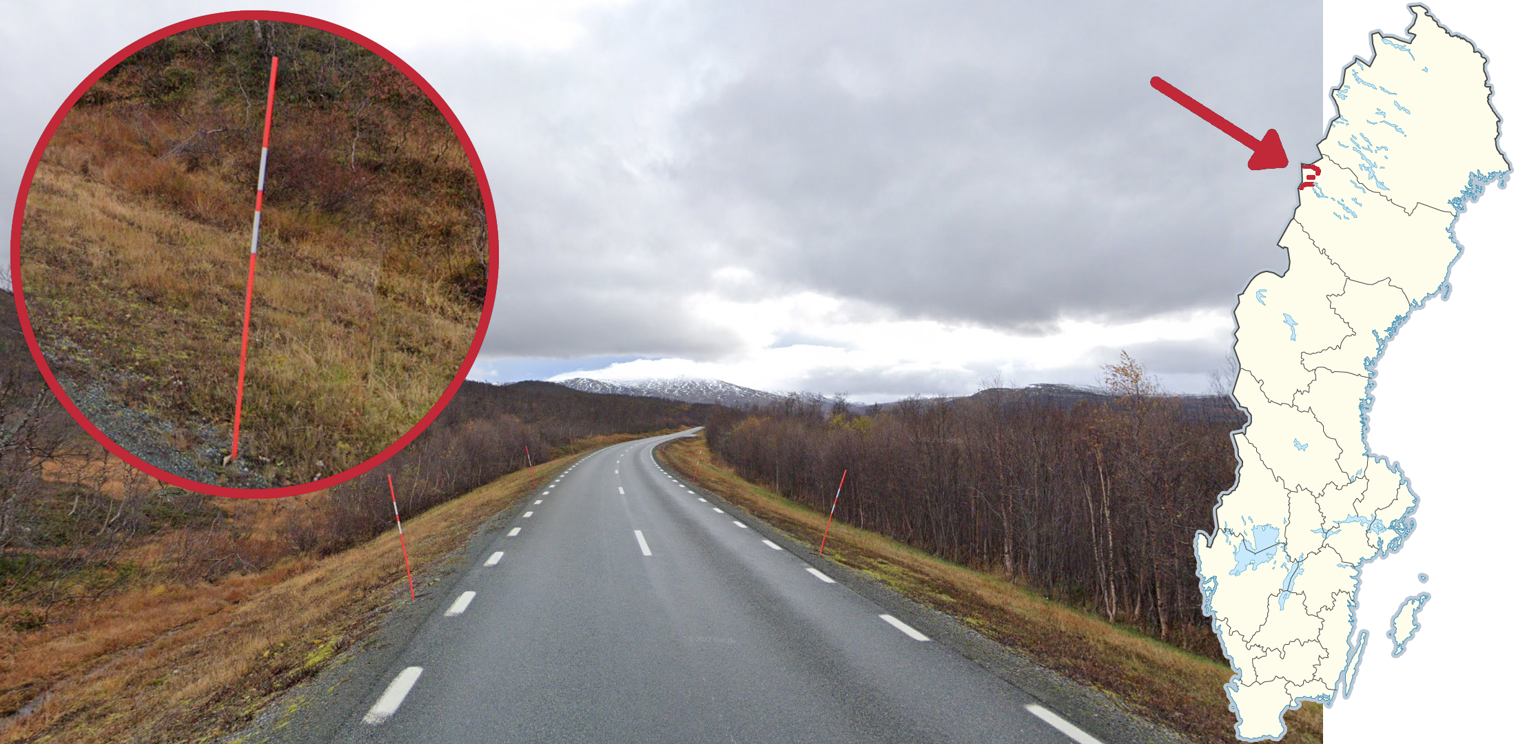
The road going between Kittelfjäll and the Norwegian border is a narrow, but paved road without roadlines going through a mountainous landscape, which was covered during summer in Generation 2.

Most mountain roads in Sweden have been built below the treeline, resulting in small trees being visible on almost all coverage. However, a small stretch of road on the border between Jämtland and Västerbotten has no visible trees, which in combination with the Generation 2 or Generation 3 summer coverage makes it unique for the Swedish mountain range.

The highest altitude public road in Sweden, which is a dirt road going straight over a treeless mountain plateau, was covered in Generation 4 on a cloudy day during summer.
NOTE: The highest point on the road features a parking spot and is right on top of the “Falkvålen” label.
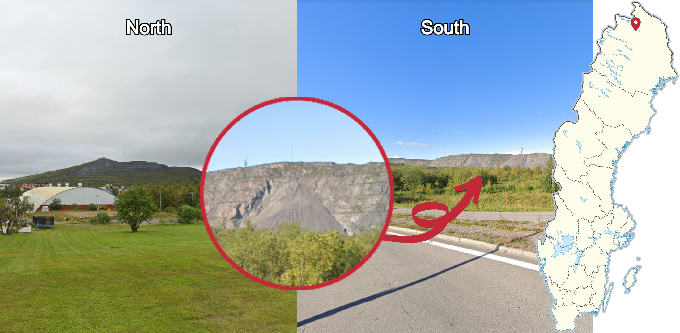
In Kiruna it is very common to get a glimpse of one of the two mountains which have taken shape as a result of the local mine, one to the south and one to the north. On the side of both mountains, different layers in the shape of a staircase may be seen, which is a very strong indication of the town. The mountains may also be spotted from the E10 west of the town.
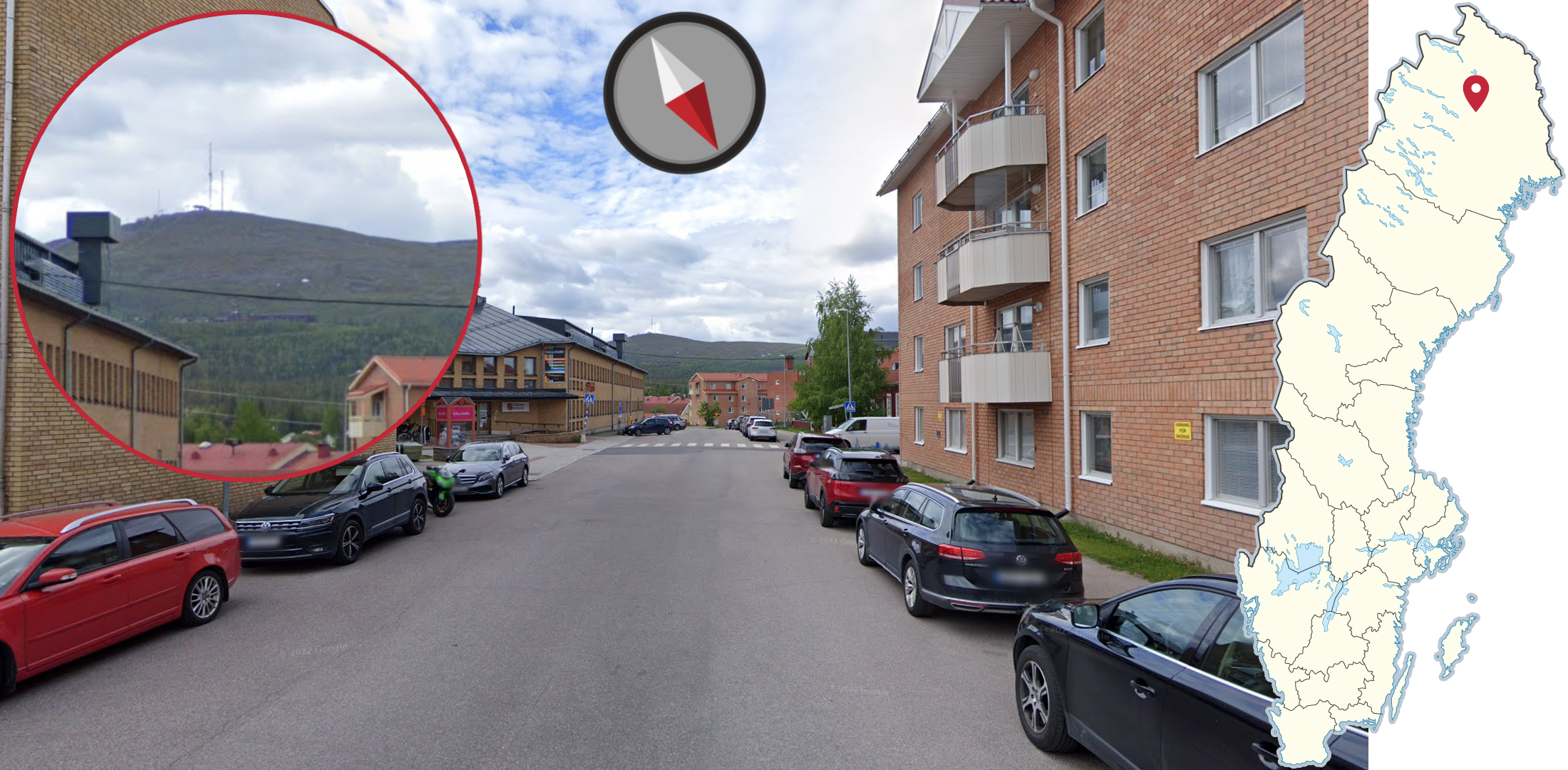
In the town of Gällivare you can often see a mountain with a smooth slope and a low tree line to the southwest. No other town in Sweden has a natural treeless mountain in such close proximity.
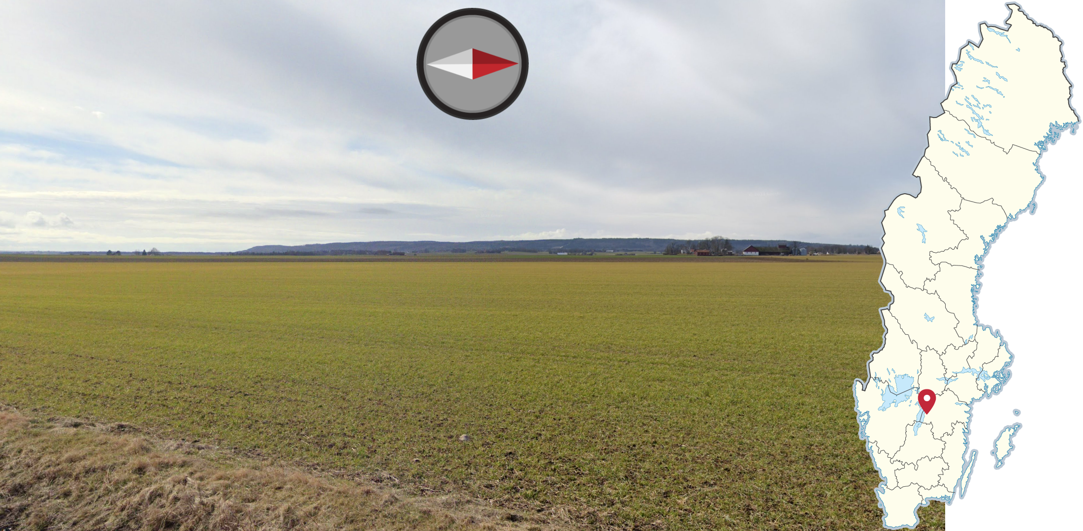
If you are surrounded by flat agricultural fields, with a single forested hill range to the west, you are likely to be east of Omberg in western Östergötland.
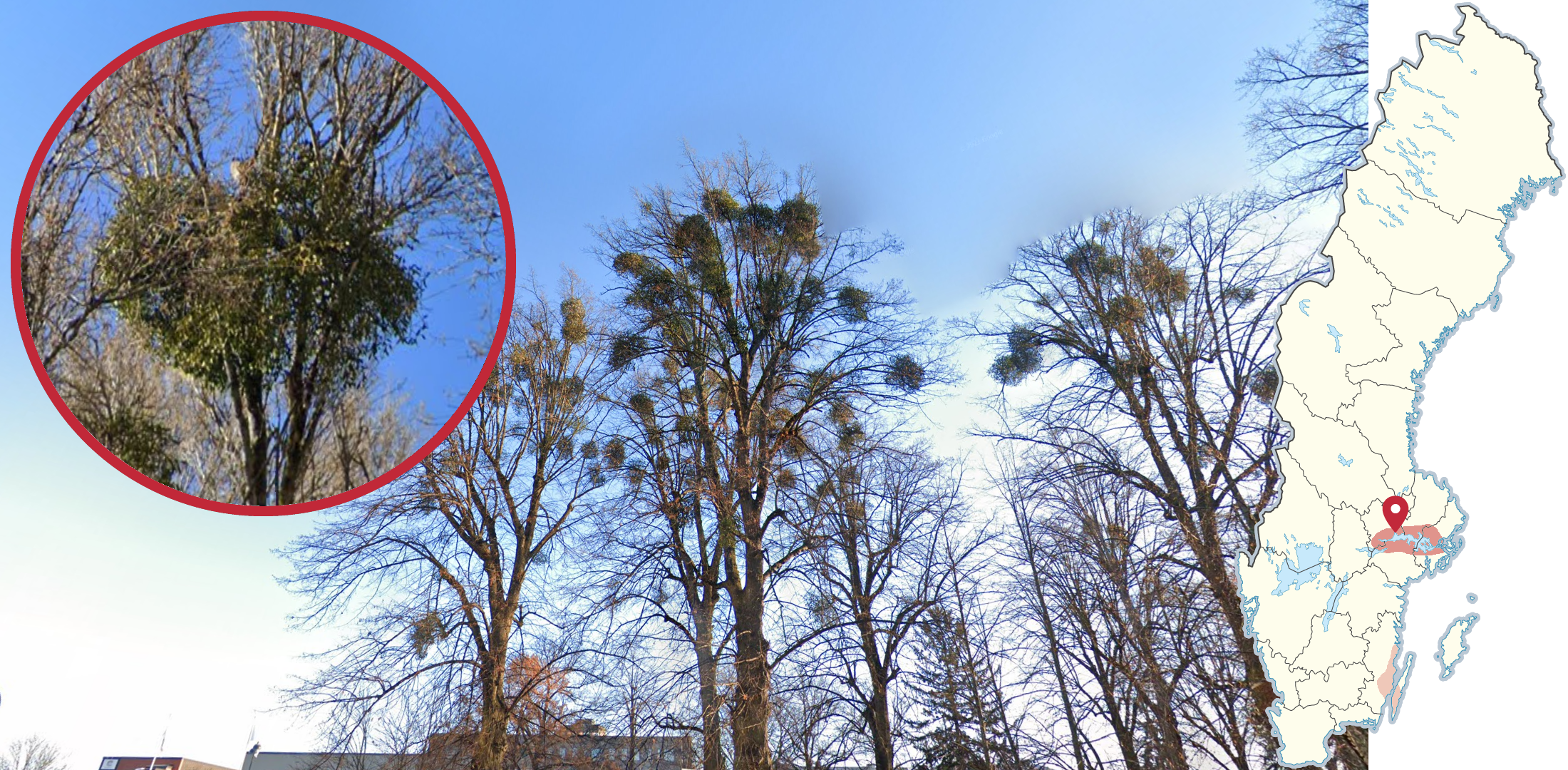
Mistletoe is mainly found near lake Mälaren and is particularly common in the city of Västerås.
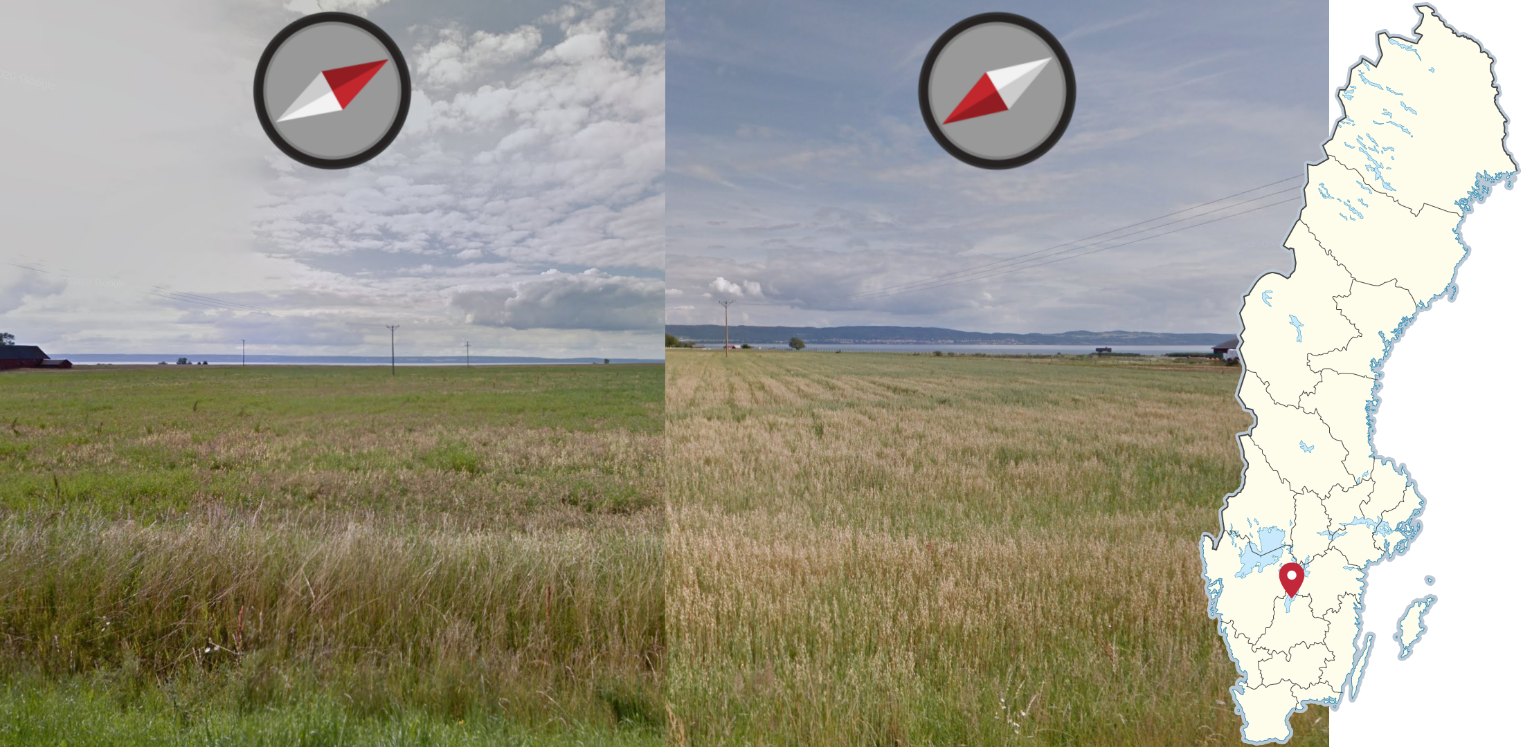
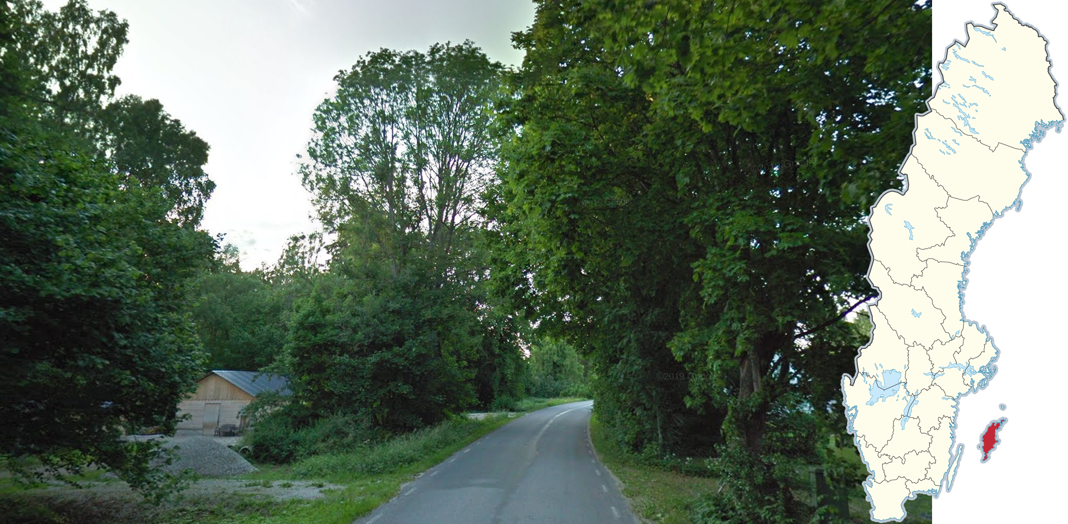
The island of Visingsö in the middle of Lake Vättern can often be recognised by the agricultural fields with the lake being visible both to the northwest and southeast, with forested hills at the shore of either side of the lake.

A majority of all large orchards in Sweden are found around the town of Kivik on the east coast of Skåne.
Large orchards can also be found northeast of Kristianstad in Vånga, around Båstad, and on the southern east coast of lake Vättern.
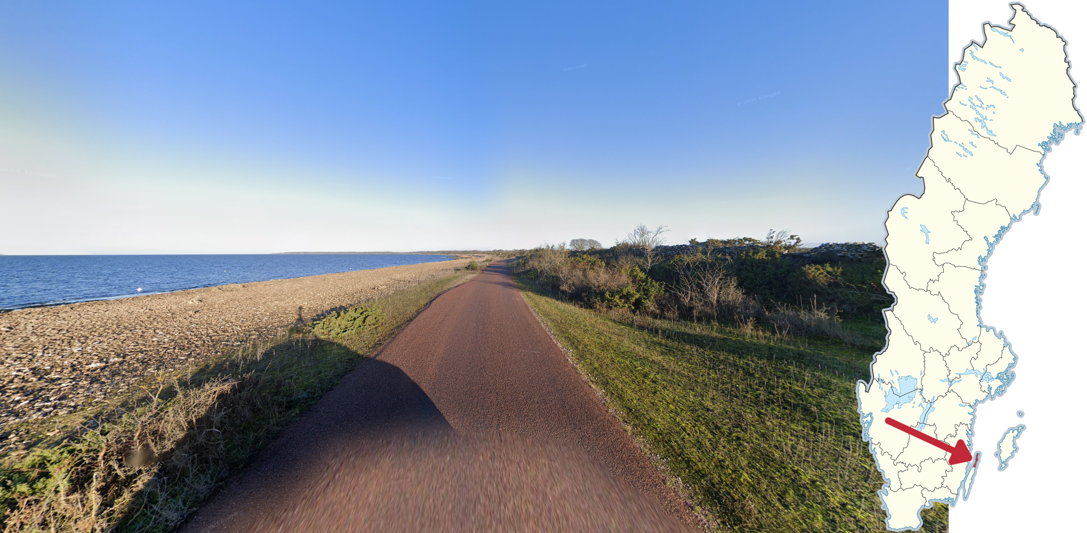
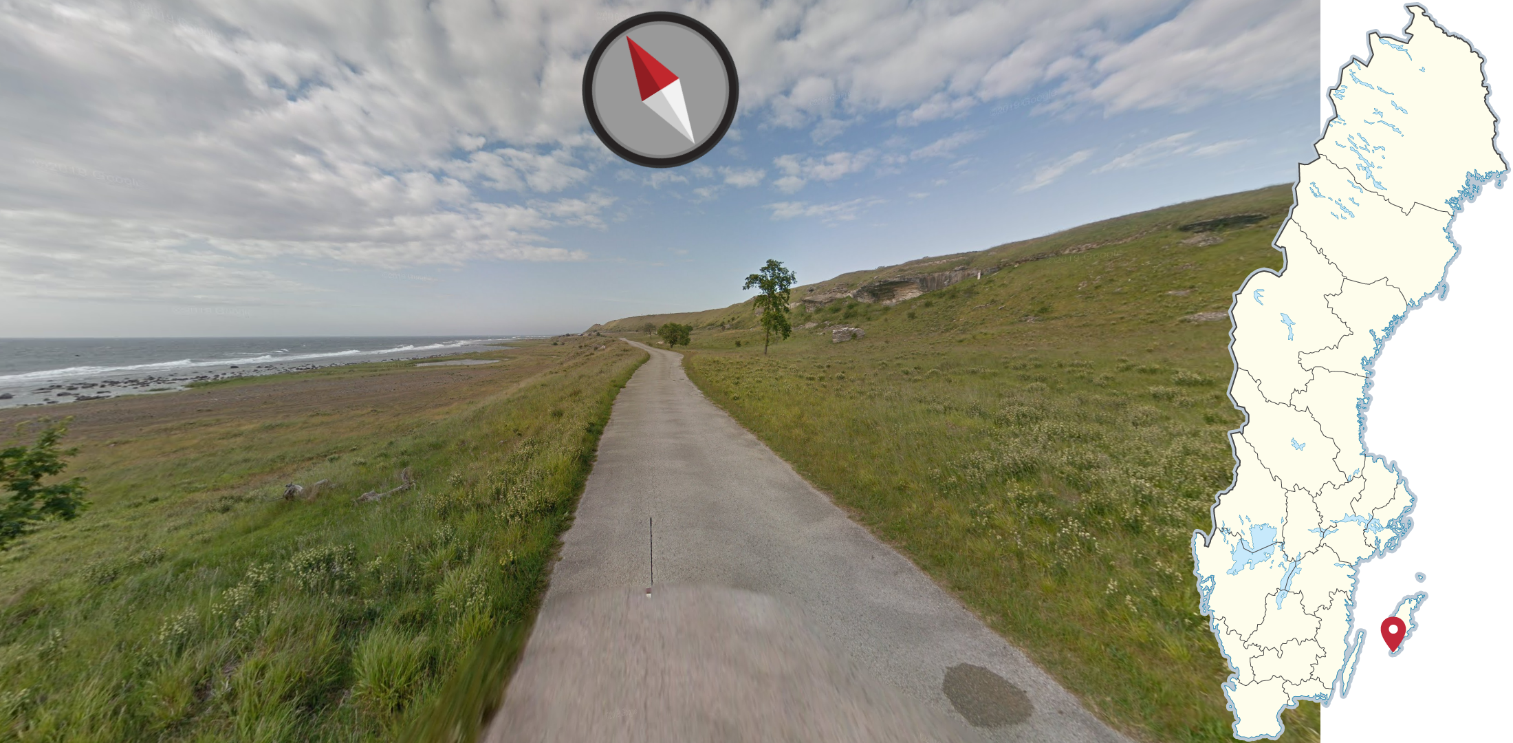
Following the northern west coast of Öland you will find this small coastal road, with a rocky beach and low, bushy vegetation.
If you suspect you are on Gotland, and see small, dry stony fields with tiny green bushes, you are very likely to be on Fårö. This landscape becomes more extreme near the north coast of the island.
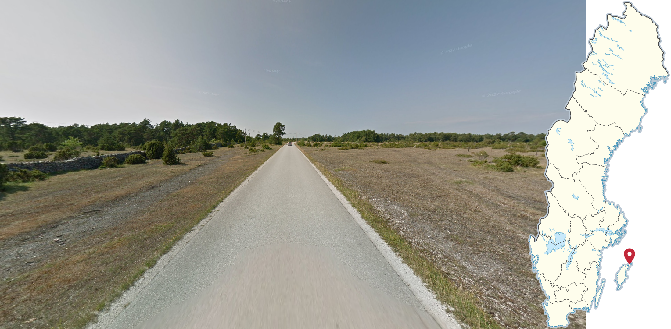
On the southern tip of Gotland you can find this west coastal road with grassy fields and a grassy hill ridge to the east.
Architecture

Near the coast north and east of Uppsala, you can come across old factory towns called Walloon mills. They typically consist of long rows of identical residential houses, which can either be made of brightly coloured stone or red wood, as well as small belfries, mansions and factory buildings, which are typically made in similar styles as the residential buildings.

Buildings made fully or partially out of blue or green slag stone can occasionally be found in the mining region of Bergslagen.
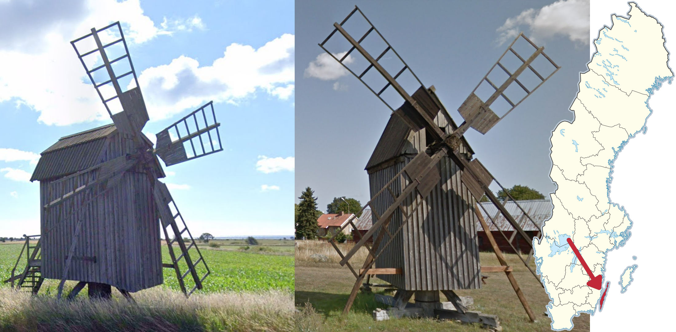
Numerous small grey, and sometimes red, wooden windmills are spread across Öland. The island has more windmills than any other region in the country.

Red brick chimneys with either a crown-like top or wide rectangular holes can be found close to lake Siljan in Dalarna county. It is somewhat common for these chimneys to be painted white.
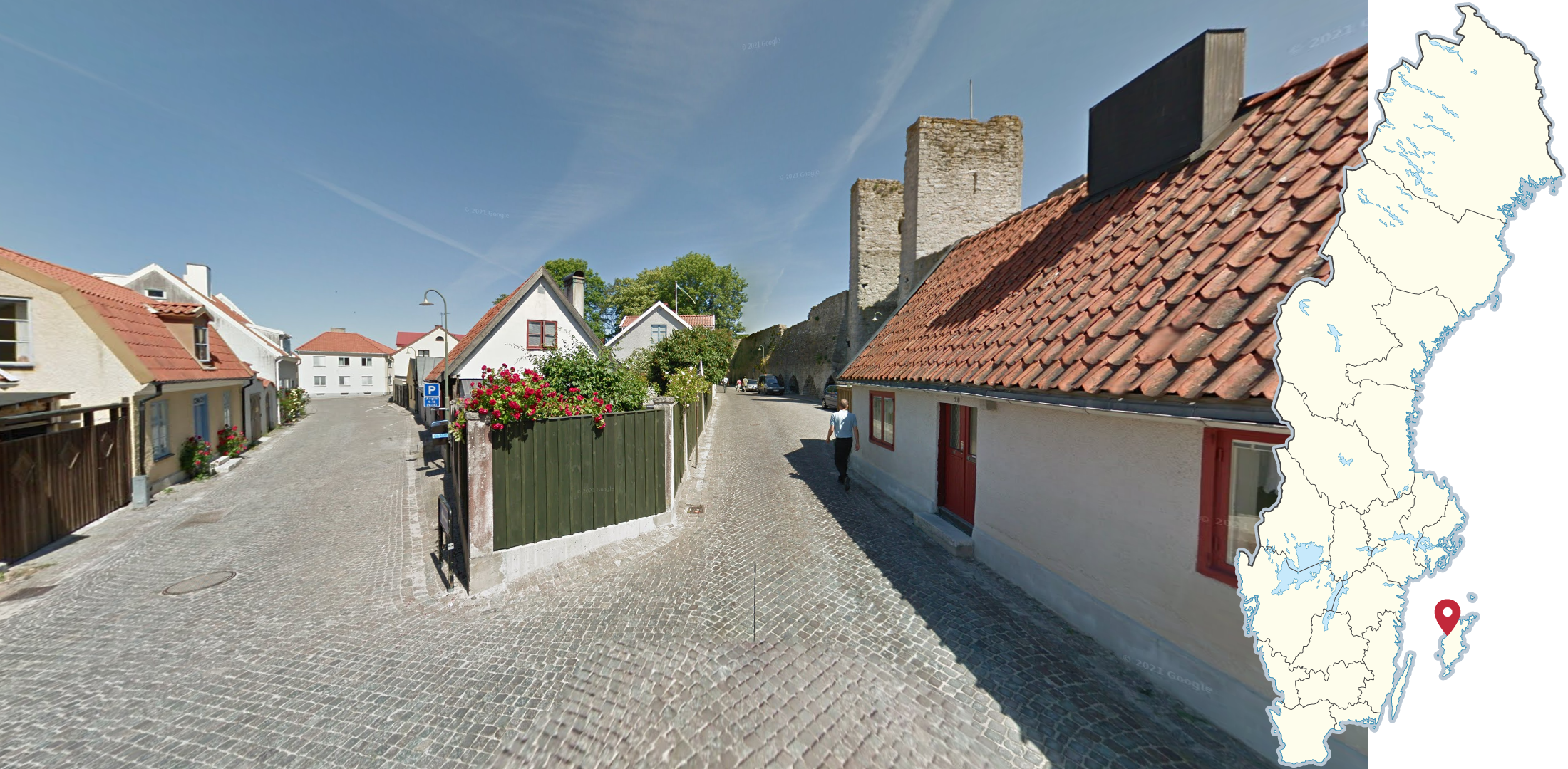
Visby is the only preserved Hanseatic town in Sweden. The inner town can typically be recognised by the cobblestone streets, combined with the small, brightly painted stone houses and an abundance of roses following the house walls. It is also quite common to get a glimpse of the old Hanseatic wall surrounding the town.
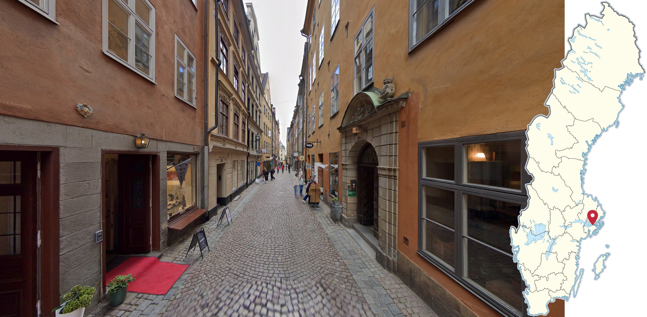
The old town of Stockholm can be recognised by the old stone buildings, usually painted in warm colours, towering over the narrow cobblestone alleyways.
Infrastructure
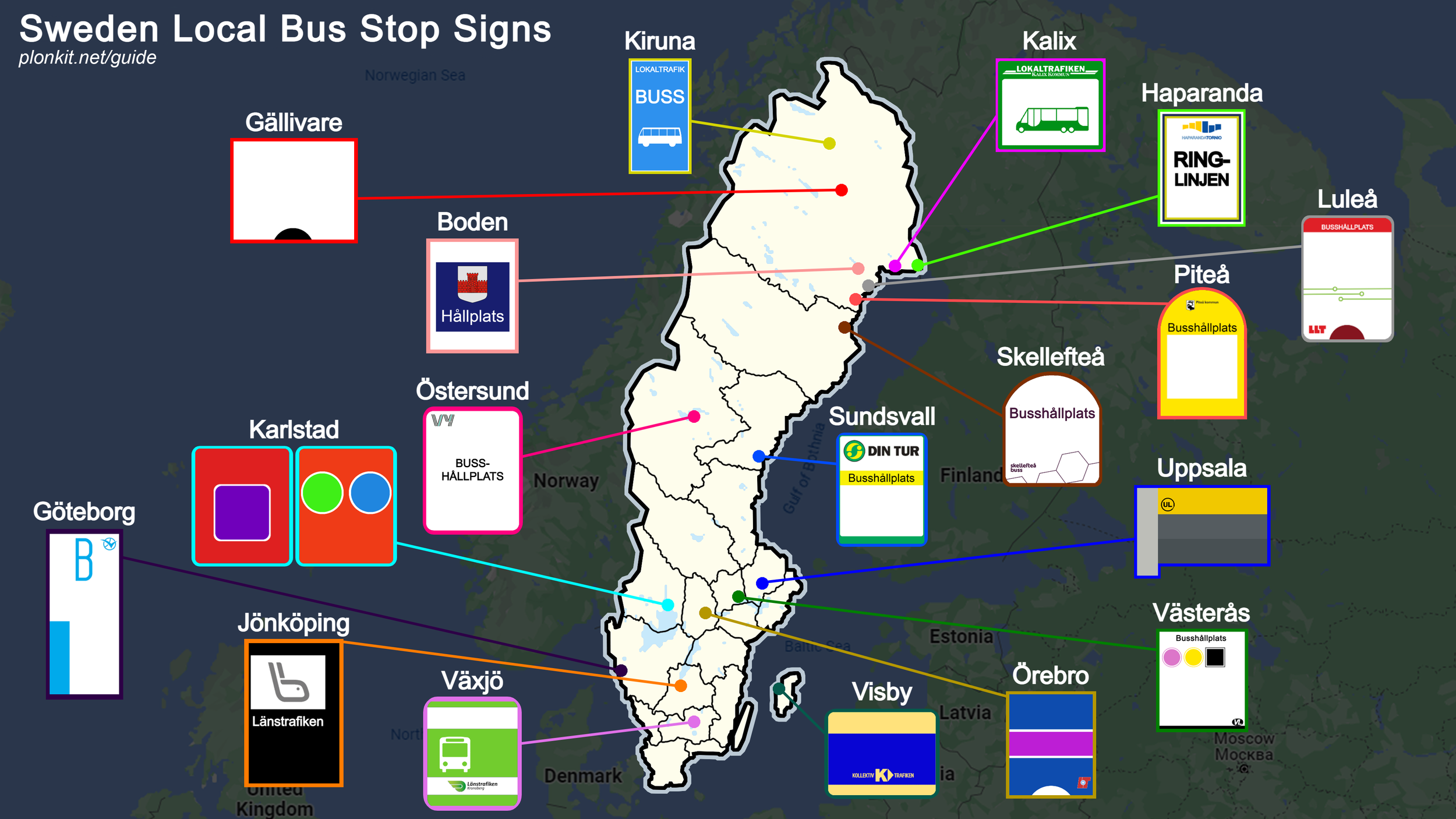
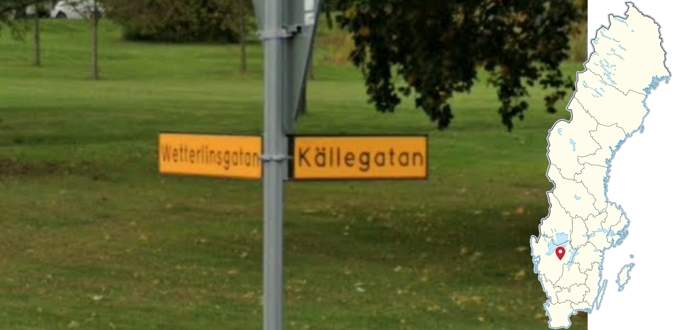
Many cities and towns have their own local bus stop signs, which are different from the signs in the rest of the region (as shown in the infographic in section 2).
NOTE: The Växjö sign can also occasionally be found in Älmhult.
You can click on the image to enlarge it.

Neon-yellow school bus stop signs are commonly found in the municipalities of Linköping, Norrköping and Jönköping.
If you see Västra Götaland bus stops combined with three blue stripes as shown in the picture, you are in Kungsbacka municipality.
NOTE: These same stripes are found on bus stops in all of Halland.
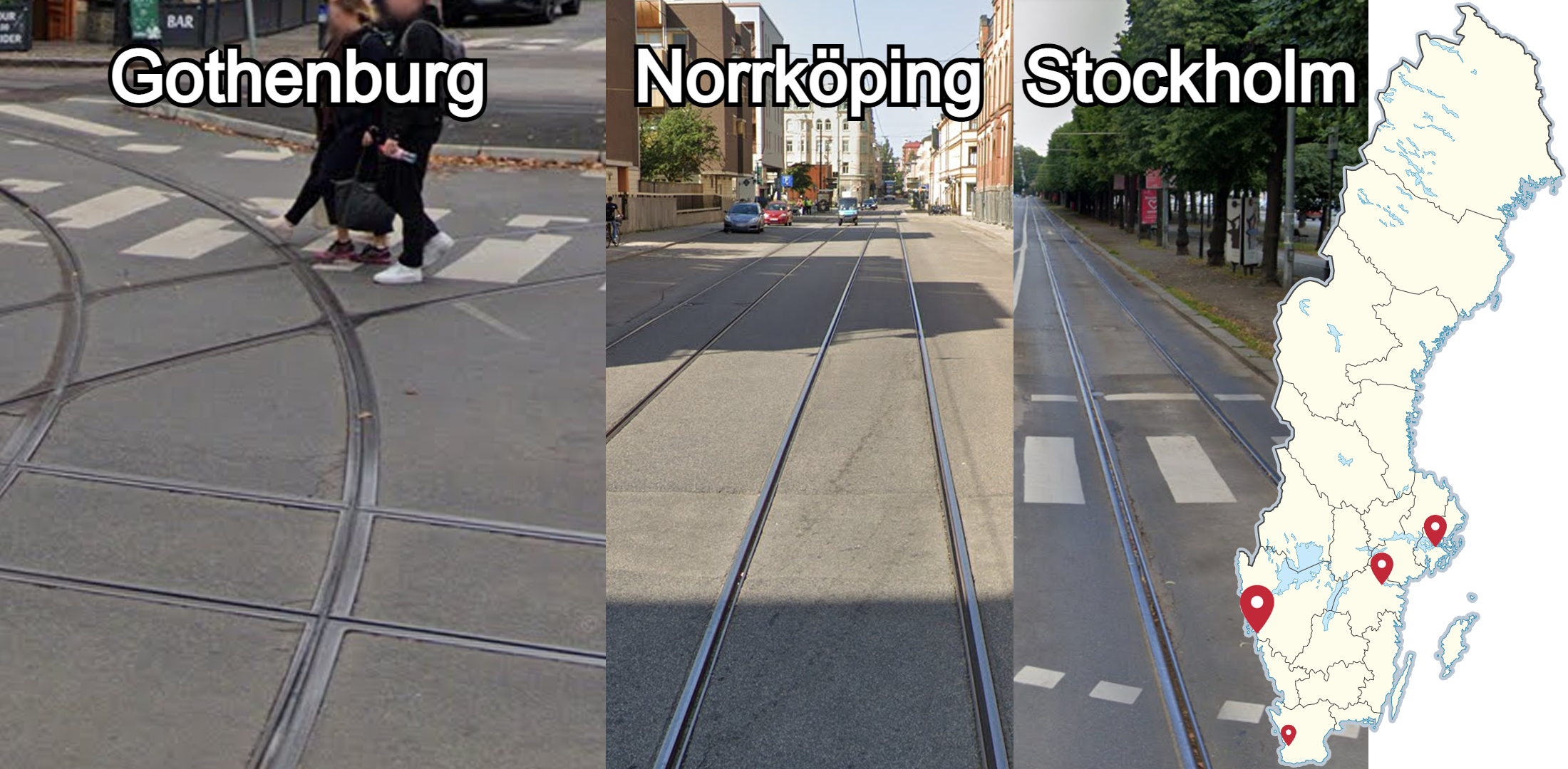
Trams can be found mostly in Gothenburg, secondly in Norrköping and Stockholm, and rarely on Generation 4 coverage in Lund.
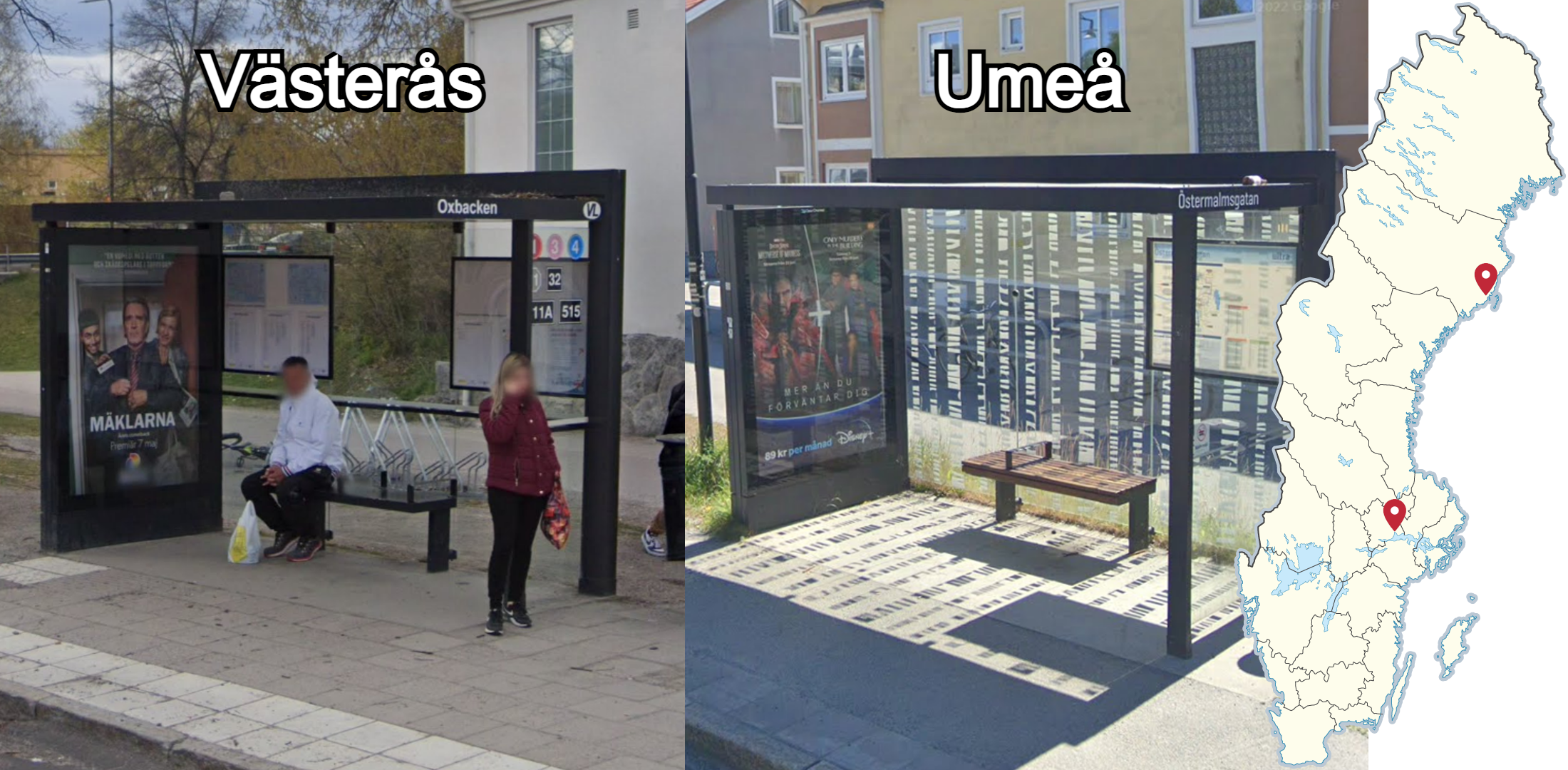
Black bus shelters with this specific design, mainly recognised by the square ridge along the back of the roof, can be found in Västerås and Umeå.

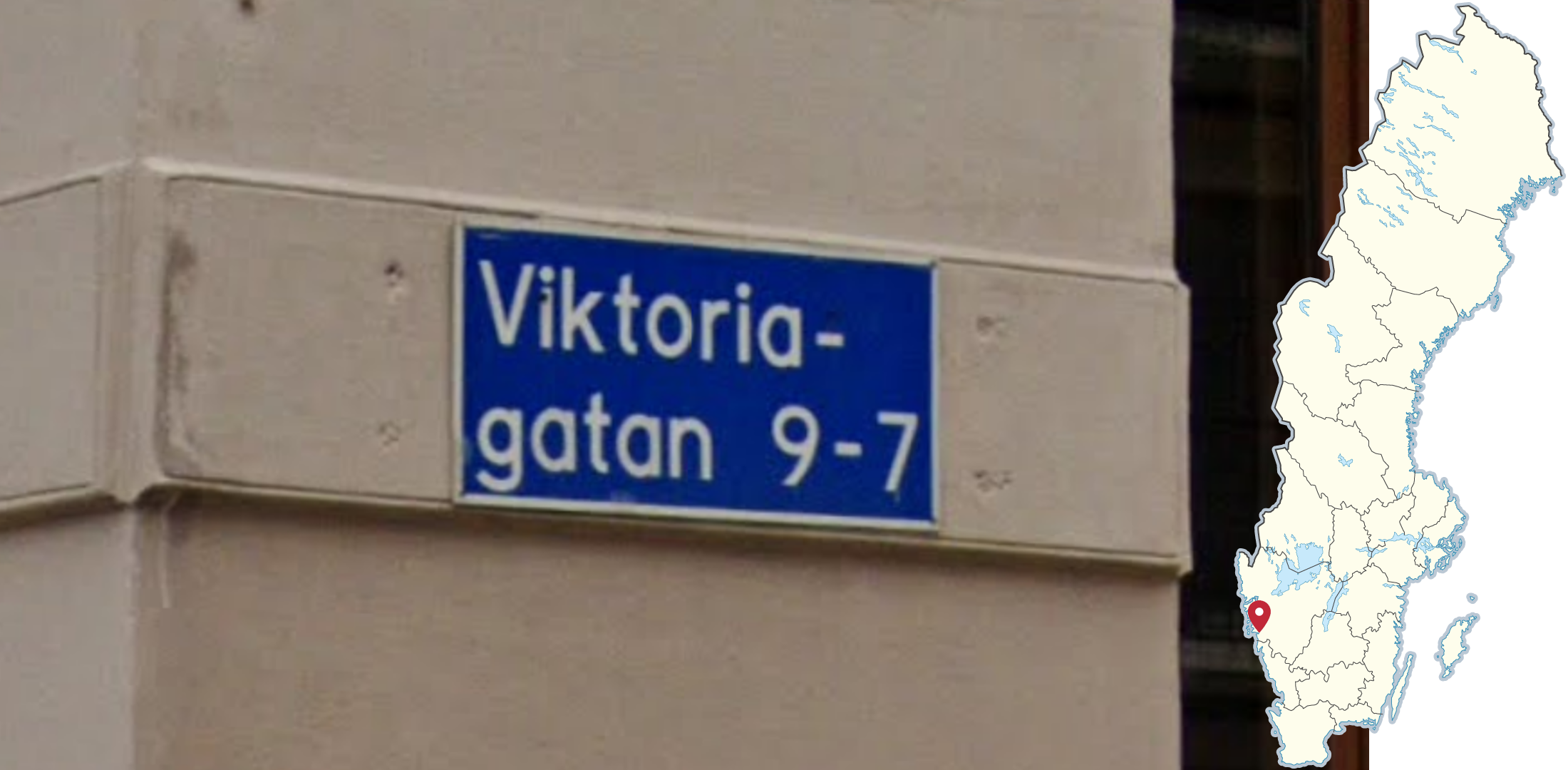
Street signs in Stockholm will have two rows divided by a black line and will usually lack a black border. Similar signs can also rarely be found in central Gävle.
NOTE: Several suburbs in Stockholm use plain white street signs.
The entire city of Gothenburg uses these unique blue street signs. Note that they almost always have two lines.
NOTE: Some other cities will have blue street signs near the centre, however they use a different design.
These somewhat old-looking, white street signs, with black corners, can be found all throughout Malmö.
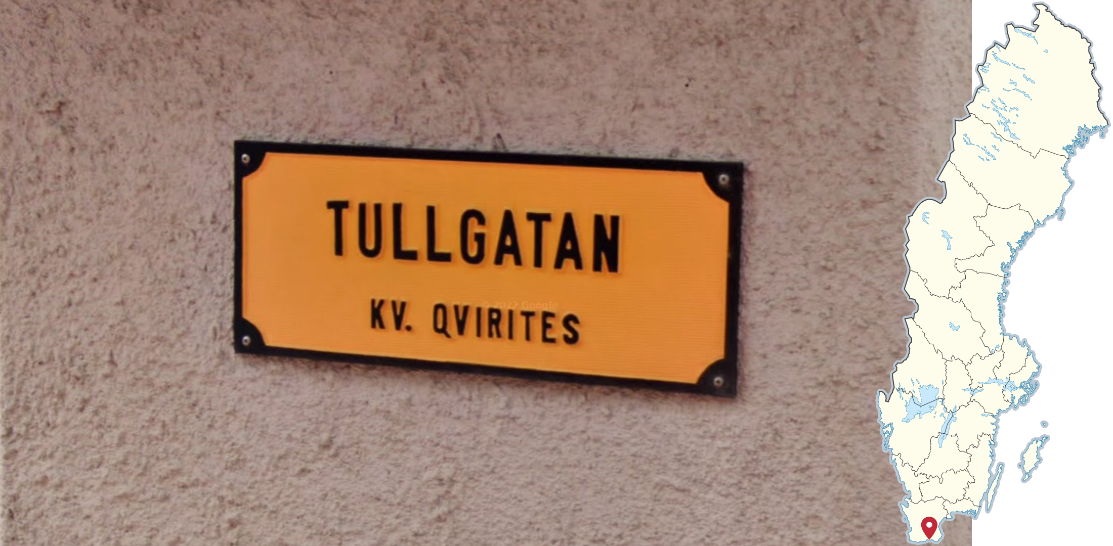
Signs similar to the ones in Malmö, but with a yellow background can be found in Ystad.
Blue street signs similar to the ones found in Gothenburg can be found in Vellinge municipality. Note that these normally only have one line, compared to the two lines on Gothenburg street signs.
Plain, yellow street signs can be found in Falköping. Note that yellow street signs may very rarely be seen in other towns, however they will always have a distinctly brighter colour.
Blue street signs with a thin, black outline can be found in Köping.
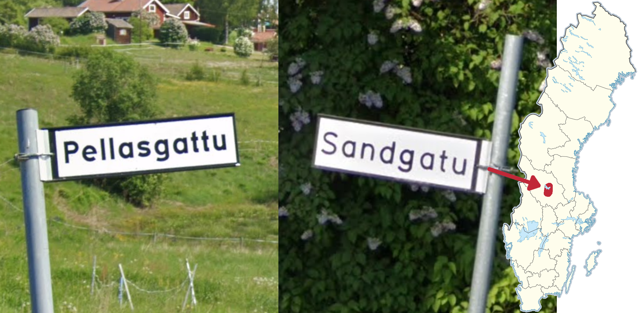
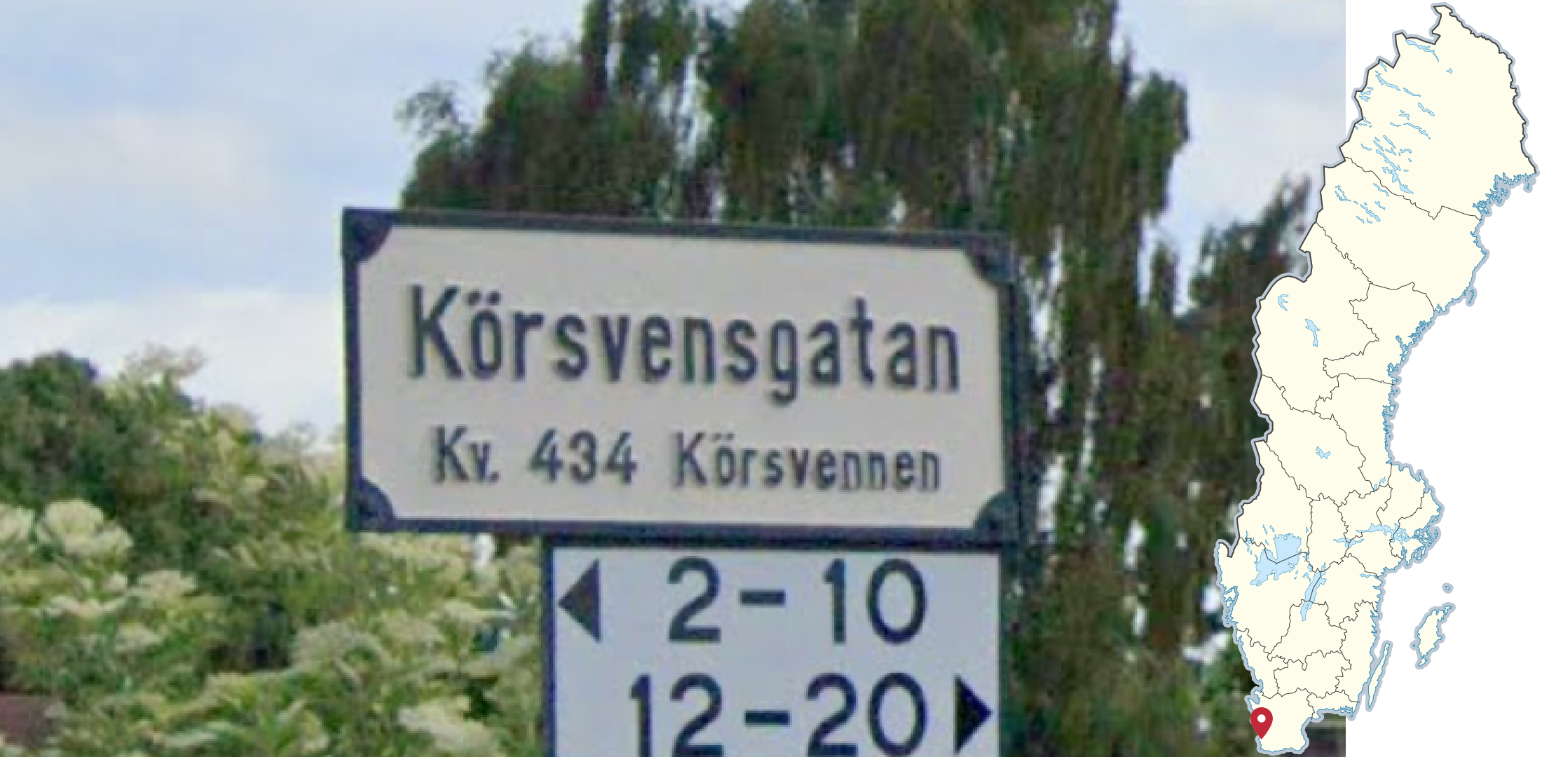
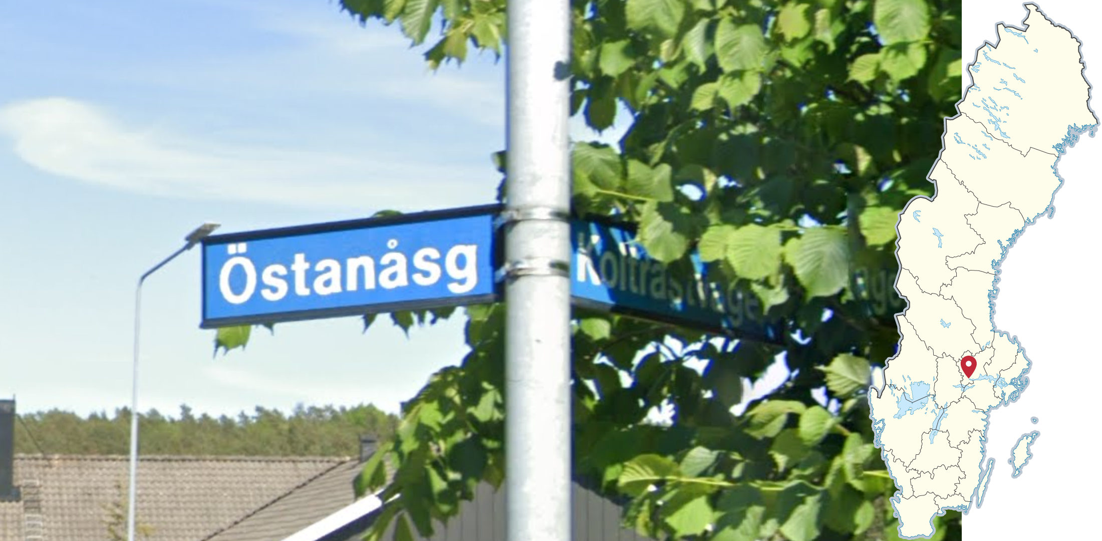
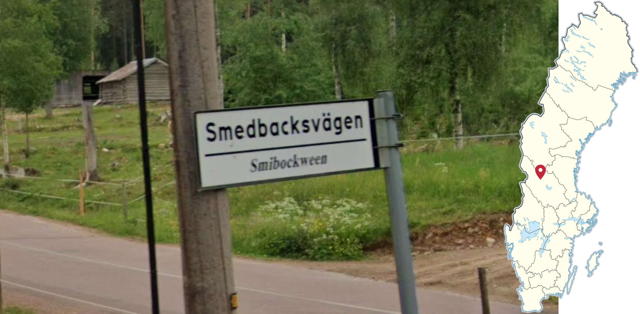
Street names ending in gattu or gatu are found in central Dalarna, near lake Siljan. Notably, gattu is found in the south of this area, while gatu is found in the north.

Three yellow stripes can be found on signposts and street lamps in Karlstad as well as on traffic lights in Stockholm.

These small yellow signs advertising tree felling are commonly found on utility poles and lamp posts in the suburbs of Stockholm. While the phone code for Stockholm is usually written on the signs, it is often difficult to make out from a distance.
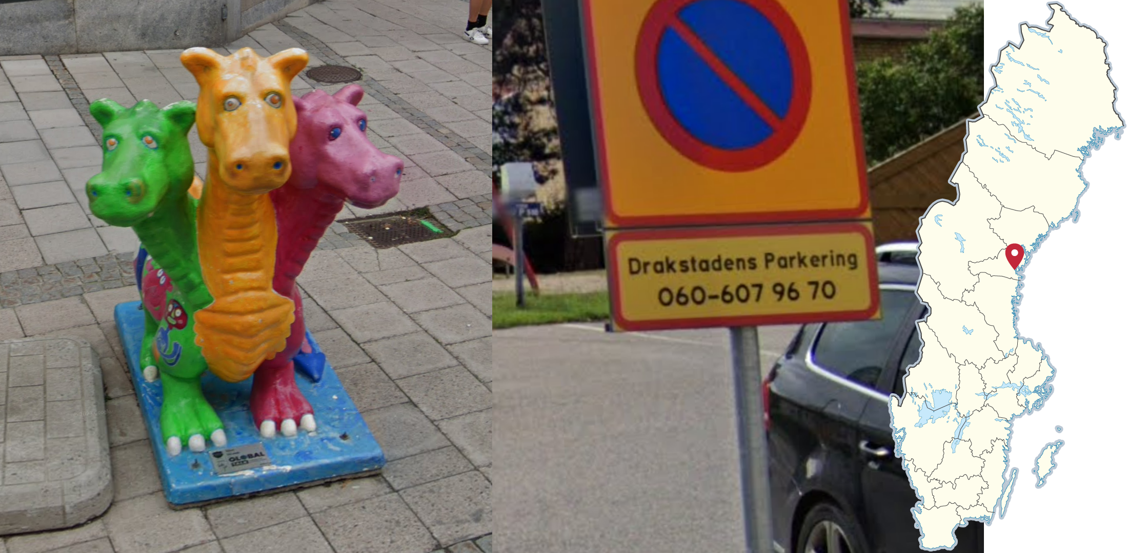
Sundsvall is known as Drakstaden (the Dragon City) in Sweden, which can be seen referenced in the form of dragon statues in the central parts of the city, and on signs.
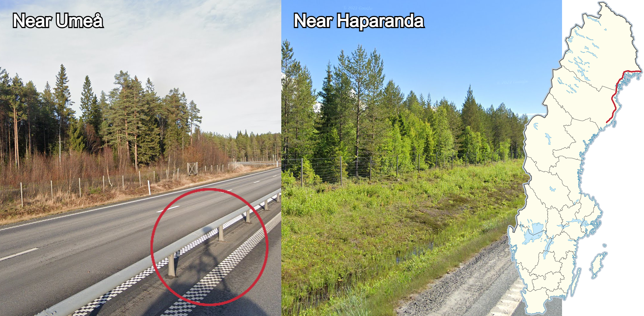
The stretch of the E4 between Umeå and the Finnish border is one of very few roads in the northern parts of the country which is large enough to normally have either a wide ditch or a barrier between the carriageways. The area is fairly flat and the road is mainly surrounded by forests, mostly consisting of thin birches and pines, which get lower further north.
If you are in a mountainous area with orange snow poles that have two wide reflectors close together, you are very likely to be near the Norwegian border on, or close to road E12.

The stretch of road 95 closest to the Norwegian border can be recognized by a large number of yellow snow poles, all having two white reflectors. The coverage can be either Generation 2 in autumn or winter, or snowy Generation 4.

If you see a mixture of orange and yellow snow poles in a mountainous area, you should be on road E10 close to the Norwegian border.
Coverage Metas
Road 95 west of Arjeplog can be recognised by the Generation 4 thawing snow coverage in a mountainous landscape. The amount of snow significantly decreases as you go further east.
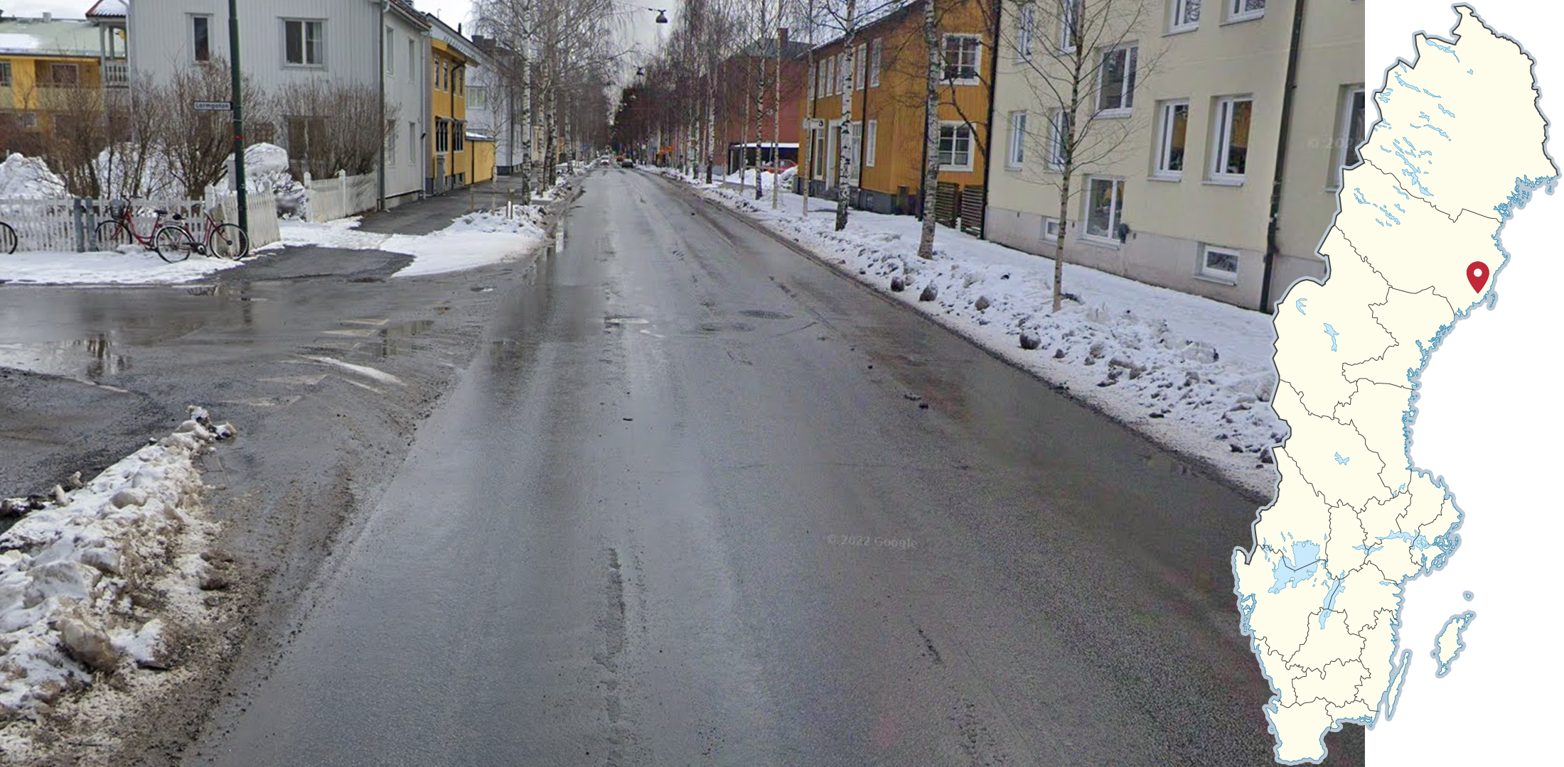
The city of Umeå has a lot of Generation 4 spring coverage, with dirty piles of thawing snow along almost every road. Almost no other city in the country has similar coverage.

The stretch of the E45 going between Orsa and Älvros can be recognised by the brown-red wet pavement with forest consisting of thin pines and birches along the roadside.
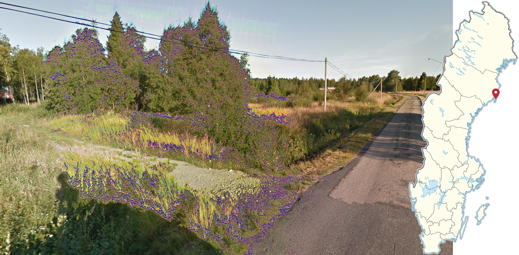
The island of Holmön has Generation 3 coverage, made by a white car with a long antenna, that features a distinctive visual glitch.
NOTE: A similar glitch can be found elsewhere, however it should be less noticeable than on Holmön.

Foskrosvägen, on the border between Jämtland and Dalarna, can be recognised by the slightly red dirt on the road, combined with several water smudges on the camera. A good way to find the road when scanning is to look for the “Reindeer spot point” right on the county border.
GeoGuessr’s own official Sweden map is not very good, for a variety of reasons. Plonk It recommends the following maps instead:
A Balanced AI Generated Sweden (map link) - 50k+ arbitrarily generated locations, balanced with streaking in mind. Not pinpointable.
AI Generated Sweden (map link) - 80k+ arbitrarily generated locations, balanced with region-guessing in mind. Not pinpointable.
Sweden / Sverige (map link) - 25k+ handpicked pinpointable locations.
IntersectionGuessr - Sweden (map link) - Arbitrarily generated locations at intersections, and therefore potentially pinpointable (but this is not guaranteed).
In addition, here are some resources to help you practise Sweden:
Plonk It Sweden (map link) - This map contains locations for practising each meta in the Plonk It Sweden guide, other than bus stops and toponyms, from step 2 to 3.
Swedish Bus Stops (map link) - Contains locations for practising every bus stop meta featured in this guide.
Swedish Toponyms (map link) - Contains locations for practising every toponym featured in this guide. Includes locations for the Sámi and Meänkieli bilingual signs.
Sweden: Cities Quiz on Seterra (quiz link) - Learn to quickly find 25 major towns in Sweden. This helps with improving your scanning times when you have signage available.